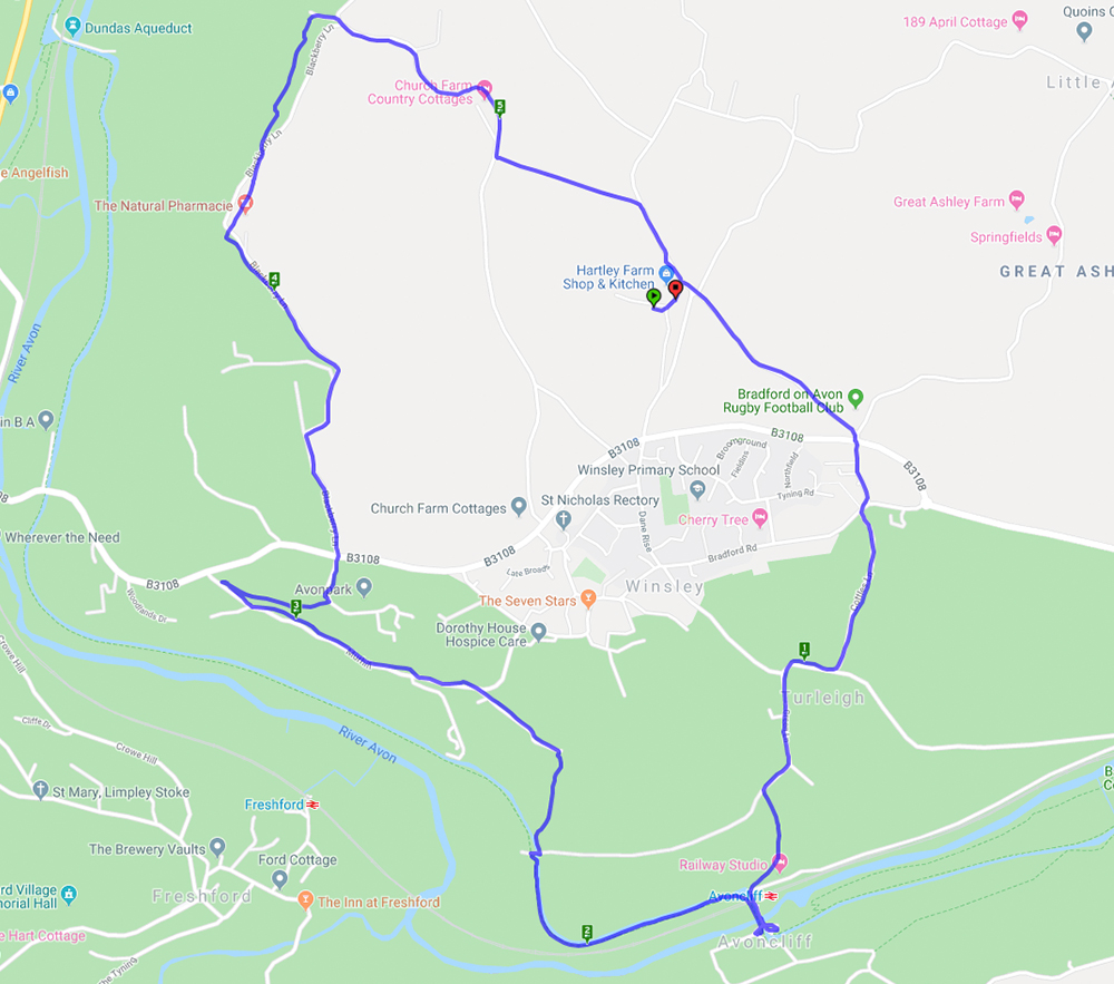
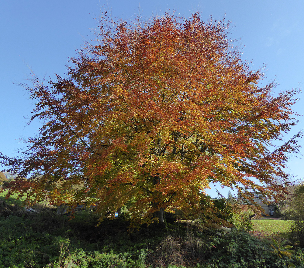
This walk started from Hartley Farm and went through Turleigh then down to the canal at Avoncliffe. The canal was a really peaceful spot for a brief coffee break. Then it was uphill through Murhill to Winsley and back to Hartley Farm via Conkwell. It was a lovely day of welcome autumn sunshine and the trees were in their full autumn colour against the clear blue sky.
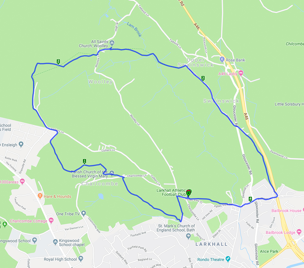
This walk started from Larkhall Sports Club and went round the edge of Charlcombe before heading up to Woolley with its attractive church and interesting graveyard and then on to Upper Swainswick. The return was via a footpath alongside but above the A46 and back through Lower Swainswick. There were several steep climbs which gave excellent views of the city and surrounding countryside.
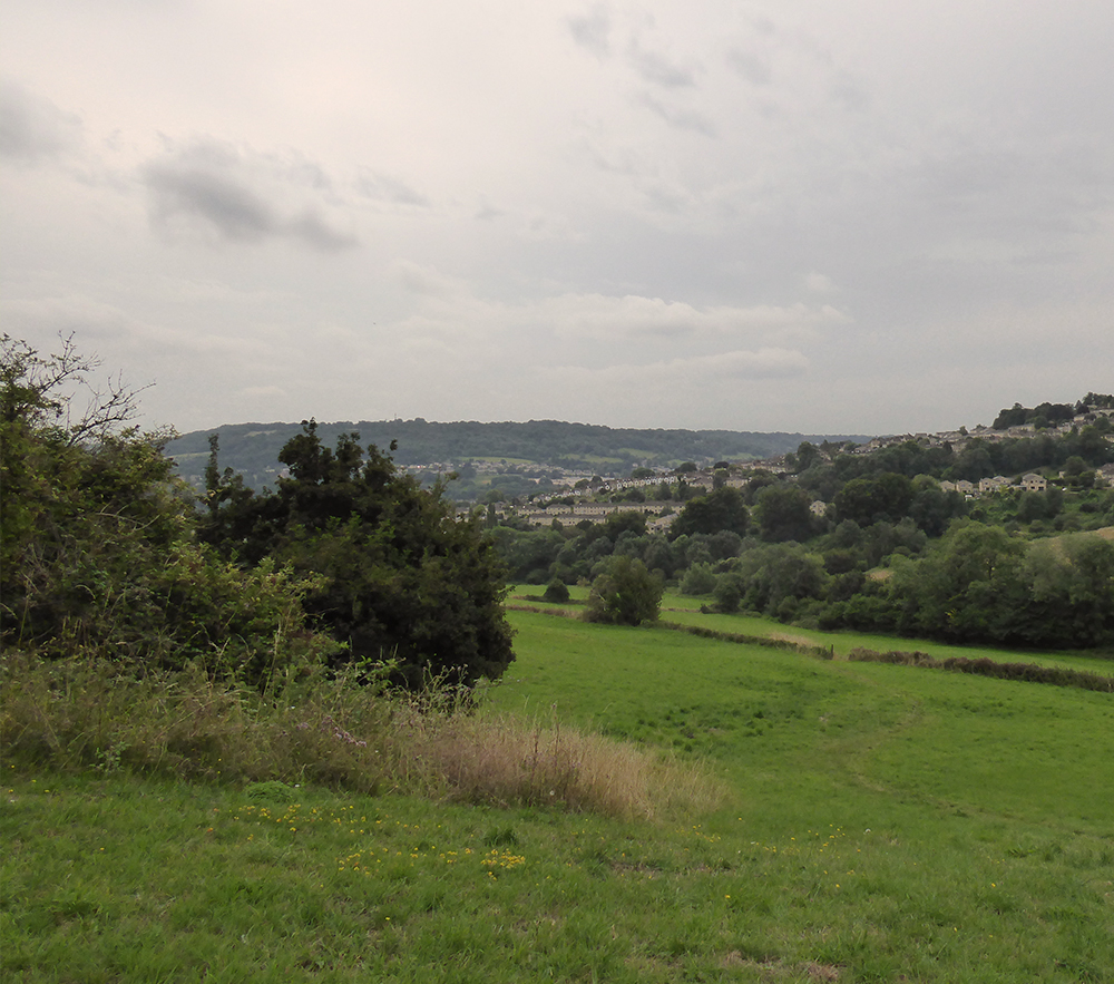
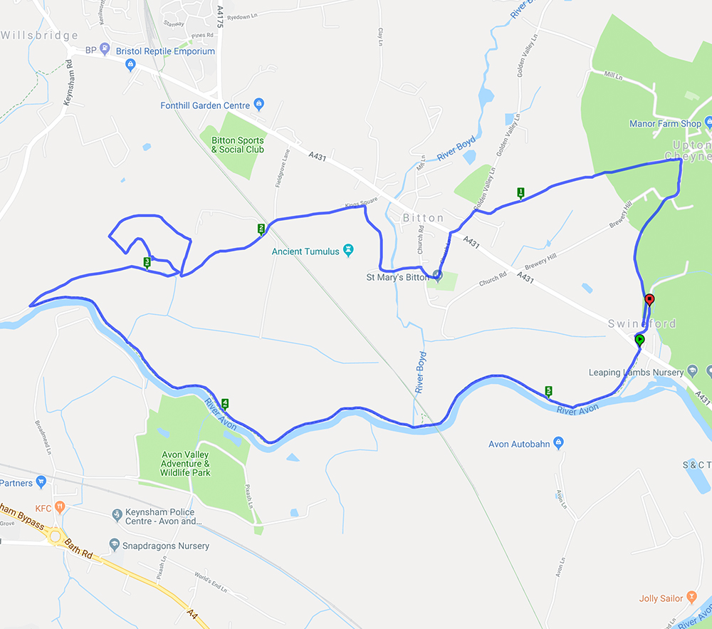
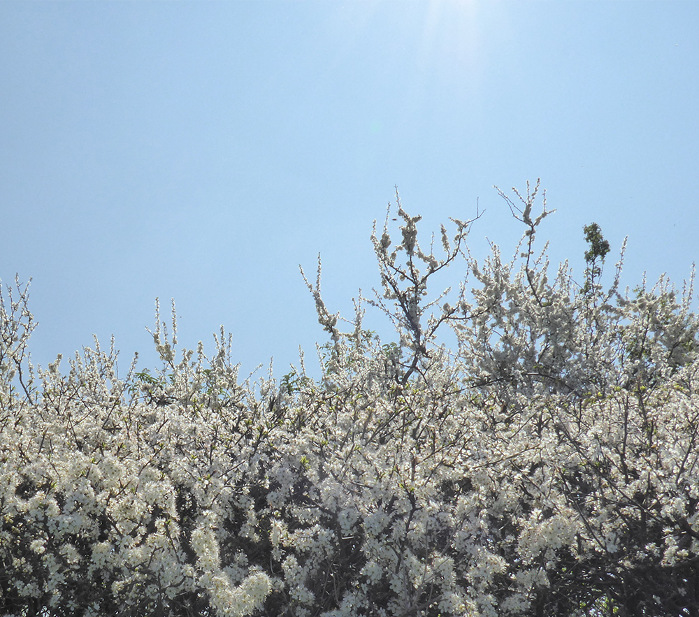
A lovely sunny Easter Sunday morning for a walk which started at Swineford before a gentle climb to Upton Cheyney and down to Bitton. After crossing the main road the path went through a grove, which was a good place for lunch, and down to the River Avon for the return to Swineford. It was interesting to note the old boat building (now repair) premises on the edge of Keynsham and the number of boats on the river.
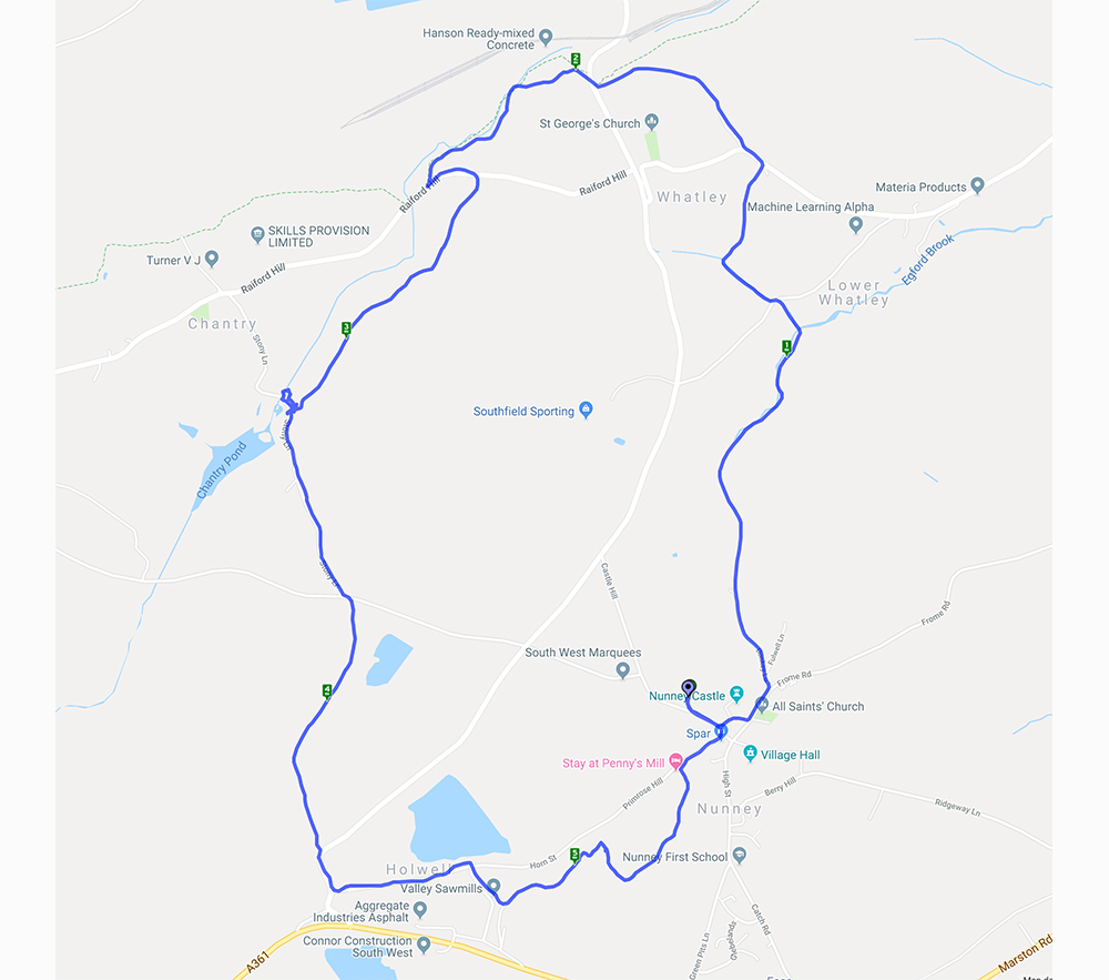
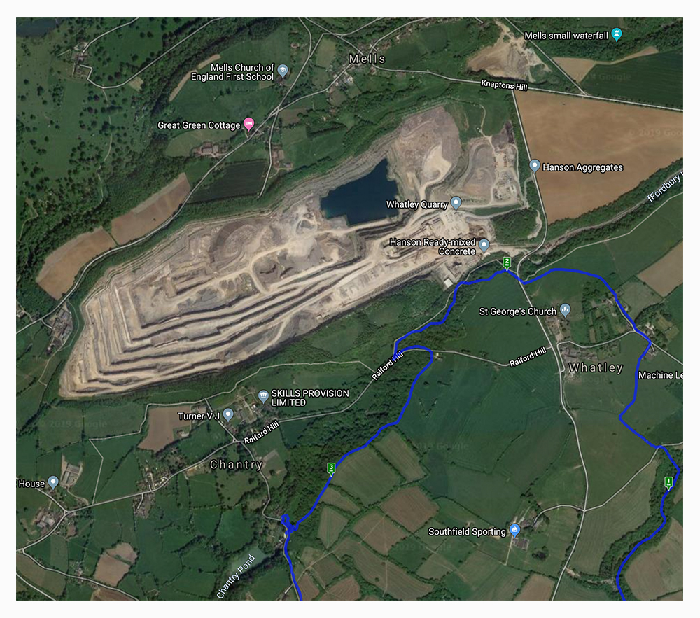
Although this wasn’t new it is the sort of walk where there is something different to spot each time. The changing seasons really do make a difference and this time the quarry was much more visible without the leaf cover on the trees. The wild garlic was everywhere and the Hart’s Tongue Ferns were looking splendid amongst the mossy growth along the stream. Another difference was a large herd of cows in a field which has not had them in before – fortunately they were more interested in chewing the cud than worrying the walkers.
The satellite view of the map shows the immensity of the quarry
This is a walk we’ve done several times before – you can see previous write-ups here and here
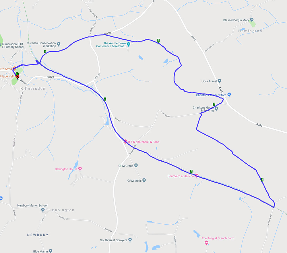
This was a lovely walk with a good mix of landscape starting from Kilmersdon and quickly joining Colliers Way which still has a surprising amount of the old railway track. Much of the trackside is lined with apple trees and legend has it that these were grown when passengers on the trains threw their apple cores out of the window. The walk then headed for the grounds of Ammerdown House with its impressive column – this originally had a viewing space at the top. This is no longer accessible but the views would have been spectacular if you could manage the climb. After a brief lunch stop to take in the views it was back to Kilmersdon.
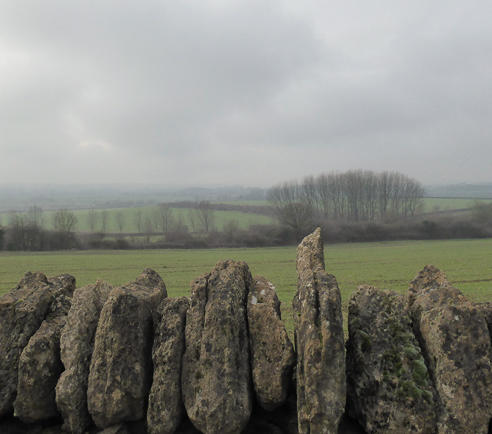
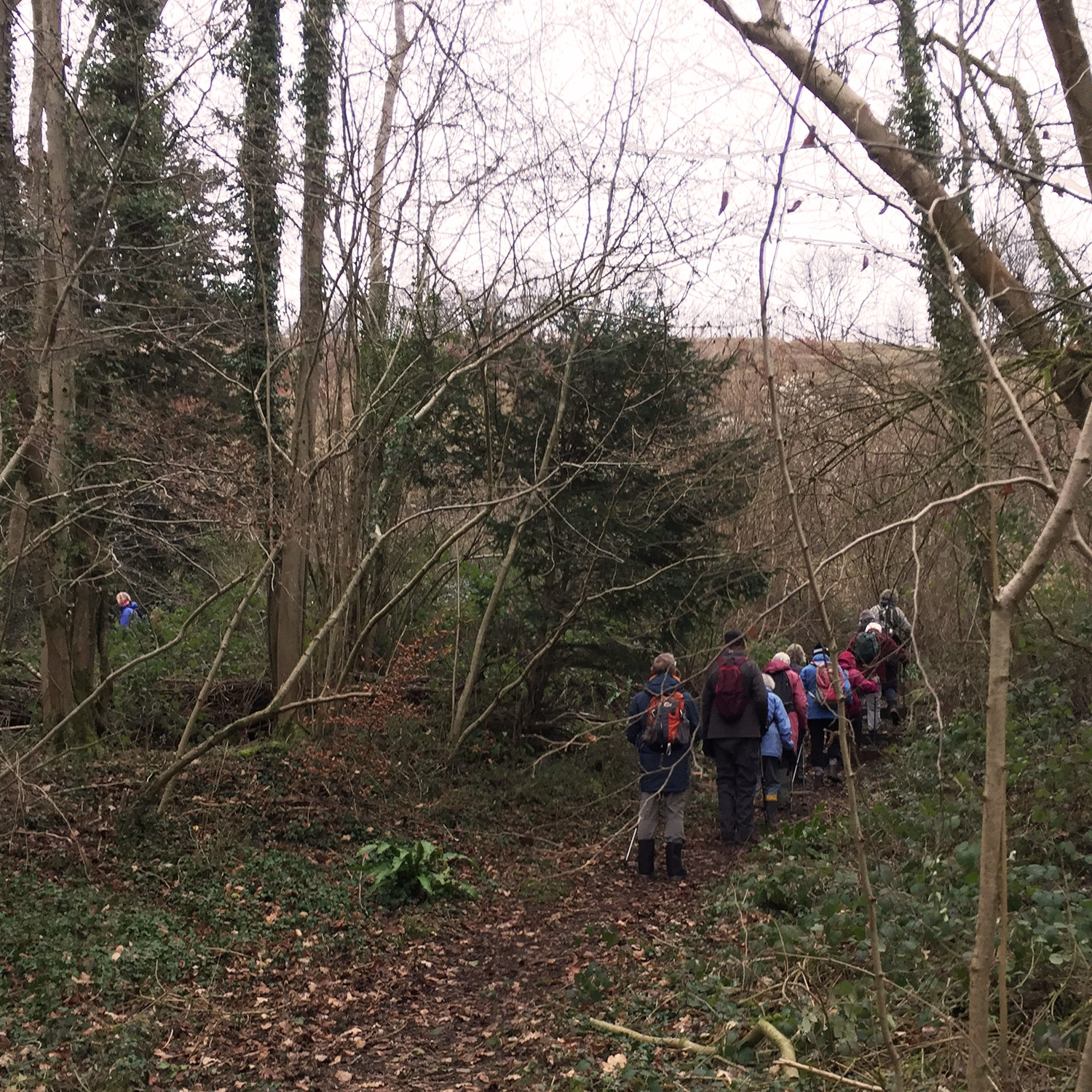
It didn’t rain today but rain never seemed far away.
Happy New Year from Bath Ramblings – don’t forget to sign up to get an email when a new route is published. There are lots of exciting walks planned for 2019.
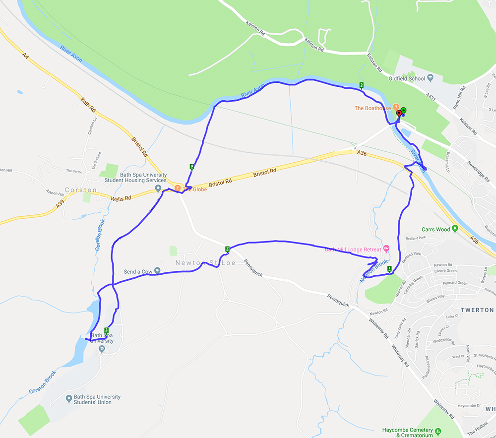
A lovely day for a walk – clear blue skies and sunshine was a real November treat. The walk started from Newbridge Park and Ride and, after crossing the A4, went along footpaths to Newton St Loe before going through the grounds of Bath Spa University. One of the lakes provided a quiet spot for lunch before returning across the A4, under the railway line and along the cycle path to the start.
A 5.2 mile walk starting and ending at Newbridge Park-and-Ride
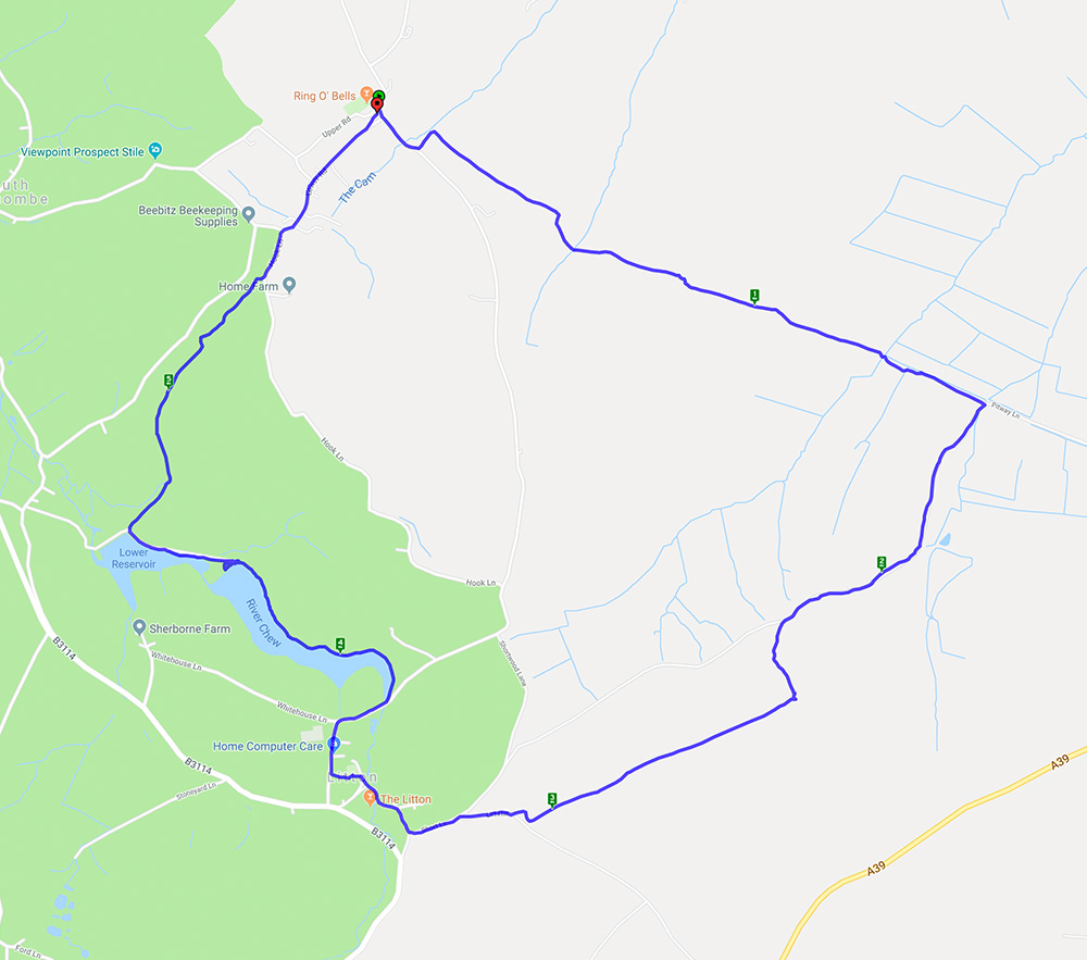
A nearly 6 mile walk starting and ending at the Ring O Bells pub in Hinton Blewett.
This circular walk started in Hinton Blewett on a gloriously warm morning. The fields were brown and the mud had solidified which made for interesting walking. Fortunately there were also some shady lanes and wooded paths. The walk went through the lovely little village of Litton where the reservoirs provided a good lunch stop and the opportunity to watch the birds on the water.
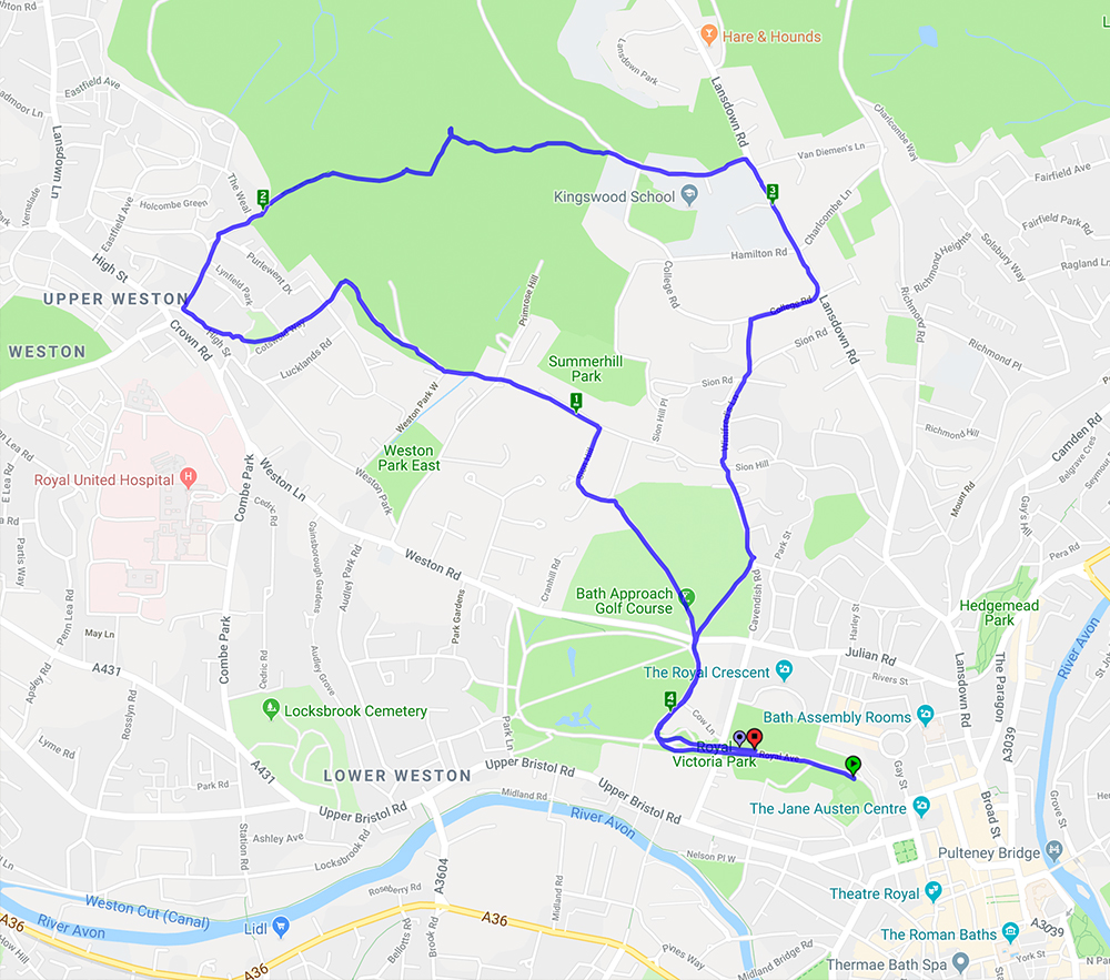
This 4.2 mile circular walk started from Victoria Park and slowly ascended to Weston village and onwards and upwards to Primrose Hill for a well earned lunch break. A glorious day for a walk with clear blue skies, warm sunshine and wondeful views across the city.
This is a walk we have done before here and here. It’s 5 miles with lots of hills (and views on a good day) and woodland.
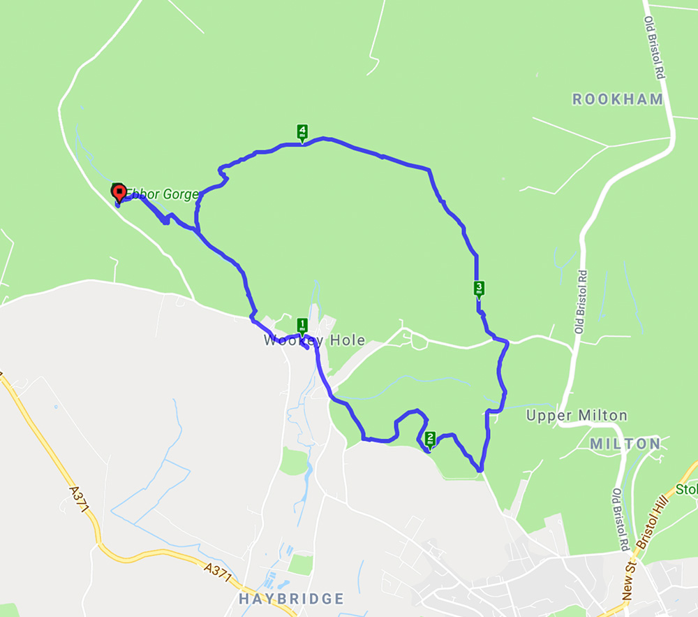
This walk started from Ebbor Gorge car park and went down to the reserve by a steep flight of steps before levelling out for the walk to Wookey Hole village. At the end of the village a path led across fields to Arthur’s Point – good views in all directions. After a stroll through woods another series of hills gave spectacular views across the Somerset levels before returning to the reserve and back to the car park. A lovely spring day with primroses, anemones, bluebells and lambs aplenty.
Thank you for visiting Bath Ramblings. Here you will find information and photos from a variety of walks around the South West. Most of these walks are organized by the Bath Ramblers – find out more on the ‘about’ page.
The maps are meant as a rough guide, if you click on the ‘walkmeter’ buttons on each post you can get more information including a satellite map.
Don’t forget to click on the ‘read more’ button at the bottom of each post for more photos.

Recent Comments