January 24, 2019 at 9:24 am
This was a lovely walk with a good mix of landscape starting from Kilmersdon and quickly joining Colliers Way which still has a surprising amount of the old railway track. Much of the trackside is lined with apple trees and legend has it that these were grown when passengers on the trains threw their apple cores out of the window. The walk then headed for the grounds of Ammerdown House with its impressive column – this originally had a viewing space at the top. This is no longer accessible but the views would have been spectacular if you could manage the climb. After a brief lunch stop to take in the views it was back to Kilmersdon.
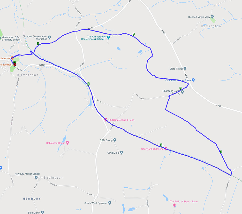

It didn’t rain today but rain never seemed far away.
July 23, 2018 at 11:16 am
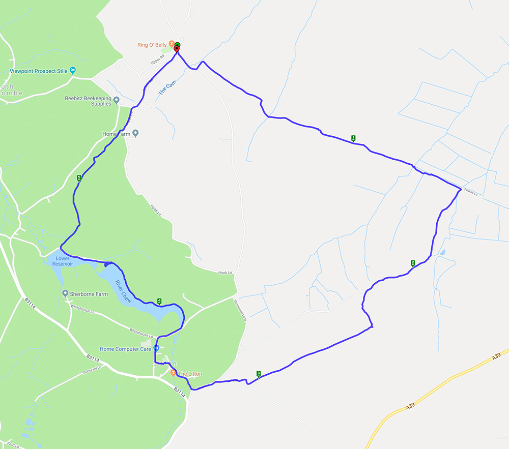
A nearly 6 mile walk starting and ending at the Ring O Bells pub in Hinton Blewett.
This circular walk started in Hinton Blewett on a gloriously warm morning. The fields were brown and the mud had solidified which made for interesting walking. Fortunately there were also some shady lanes and wooded paths. The walk went through the lovely little village of Litton where the reservoirs provided a good lunch stop and the opportunity to watch the birds on the water.
April 23, 2018 at 9:20 am
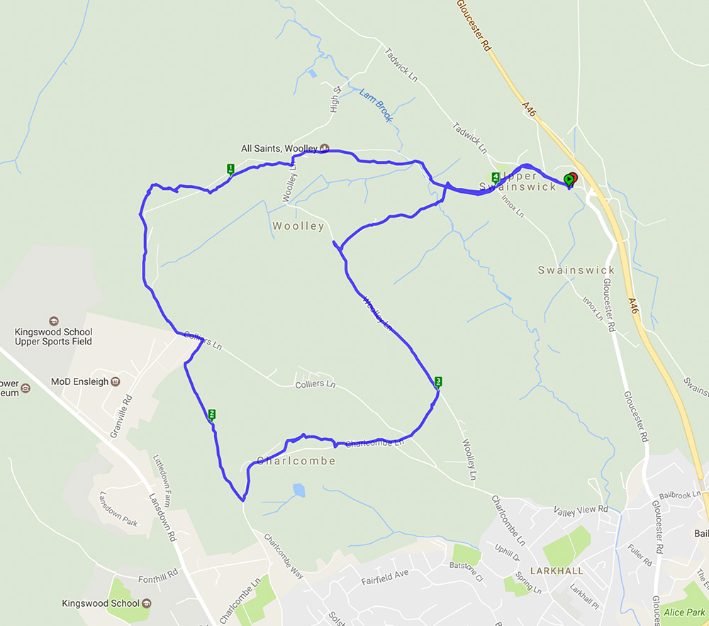
This is a walk we have done before here and here. It’s 5 miles with lots of hills (and views on a good day) and woodland.
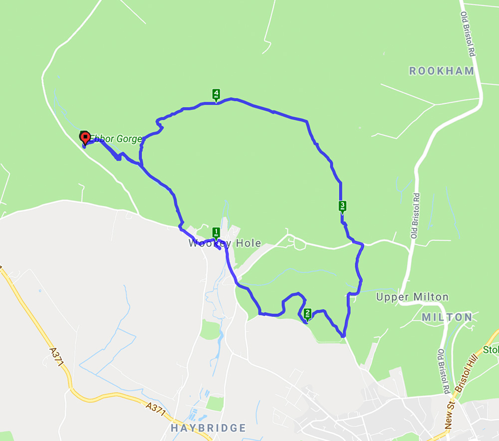
This walk started from Ebbor Gorge car park and went down to the reserve by a steep flight of steps before levelling out for the walk to Wookey Hole village. At the end of the village a path led across fields to Arthur’s Point – good views in all directions. After a stroll through woods another series of hills gave spectacular views across the Somerset levels before returning to the reserve and back to the car park. A lovely spring day with primroses, anemones, bluebells and lambs aplenty.
February 20, 2018 at 7:29 am
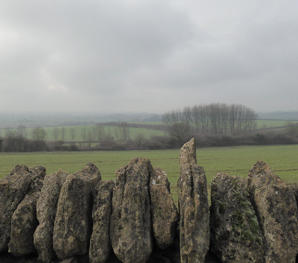
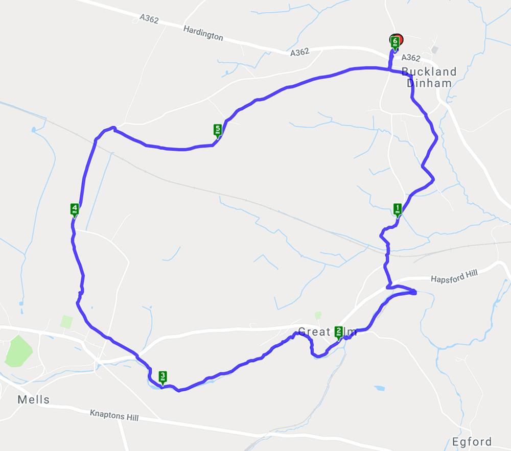
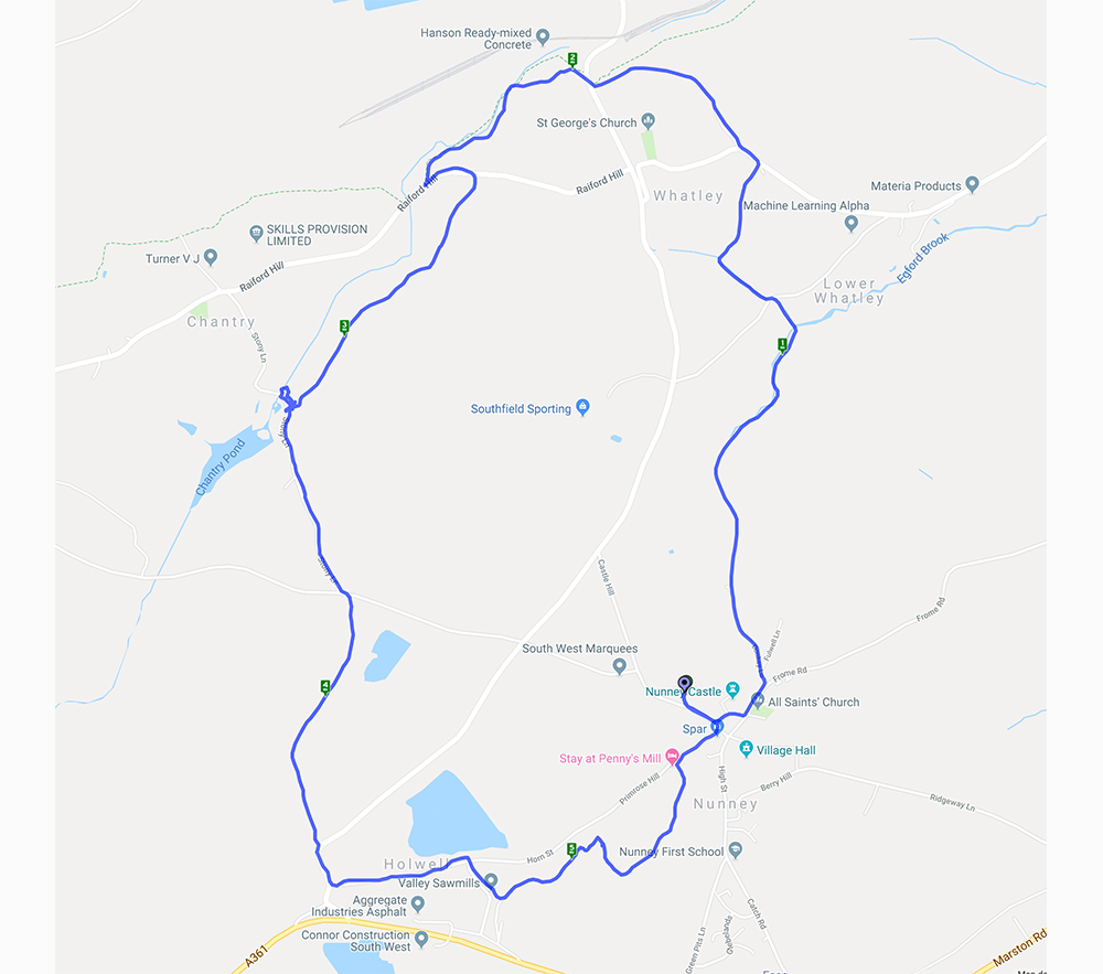
This walk starts in the village of Buckland Dinham then heads into the Somerset countryside through Great Elm and on towards Mells where the hills above the village give good views of the historic manor house and church. A good variety of walking with open fields and meadows, riverside paths and bridleways thick with mud. Signs of spring everywhere with snowdrops, daffodils in bud and wild garlic starting to appear.
August 2, 2017 at 9:08 am
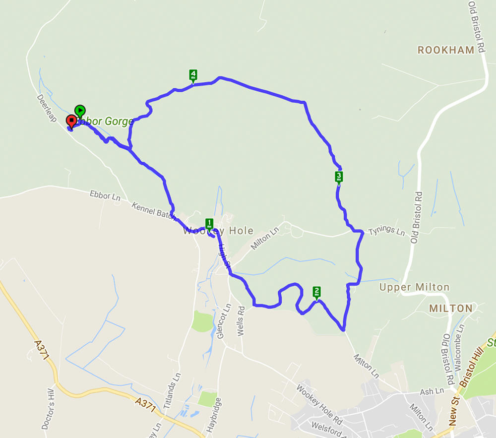
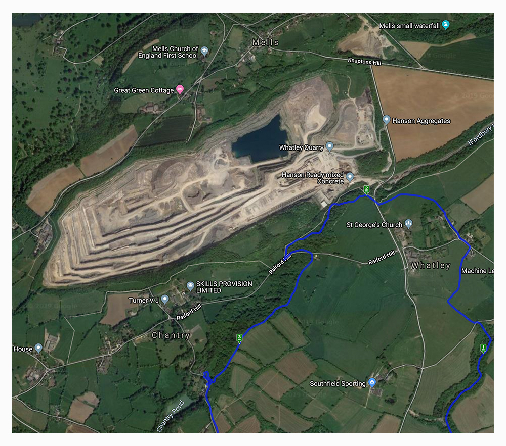
Welcome to our third featured walk which is a 4.9 mile circular hike through Ebbor Gorge on the West Mendip Way. Full instructions are below.
This walk starts from Ebbor Gorge car park and heads down into the reserve before diverting into Wookey Hole village. From there it goes across fields and through woods before returning to the nature reserve and back to the car park. A challenging walk with steep flights of steps and climbs up hills but well worth the effort for the far reaching views across the Somerset countryside. The limekilns and rock formations are an interesting addition.
April 17, 2017 at 10:14 am
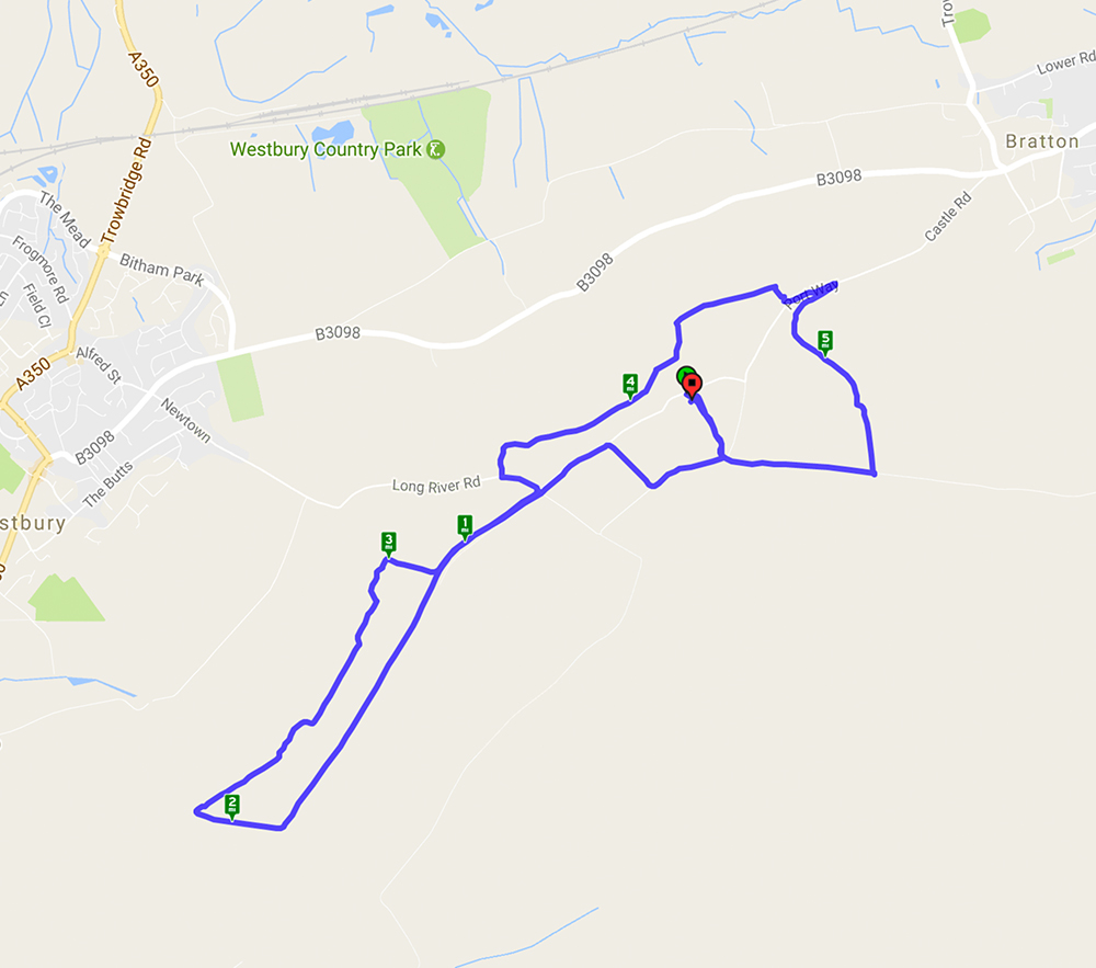
Westbury White Horse – A 5.9 mile walk starting and ending at the White Horse car park.
The walk started from the Westbury White Horse car park and went past the old chalk quarry and skirted Imber Range – no firing today! The mostly level walk from high ground gave wonderful long distance views. Paragliders and kite flyers were taking advantage of the wind. Animal highlights included a Peregrine Falcon, skylarks, very woolly brown sheep and shaggy ponies – and, of course, the White Horse. An avenue of Beech trees provided the ideal setting for coffee and Easter Eggs!
map
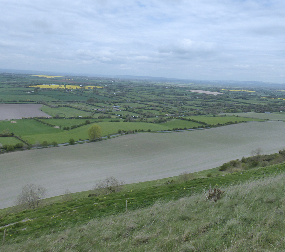
undulating fields
March 28, 2017 at 6:25 am
On a gloriously sunny spring day it was well worth repeating this walk – see walk on 31/7/16 – as the differences were clear. The views were spectacular and the wood anemones and primroses were flourishing along the stream side paths although the wild garlic had yet to flower. The absence of leaves improved the views and gave a clear impression of how large the quarry was!
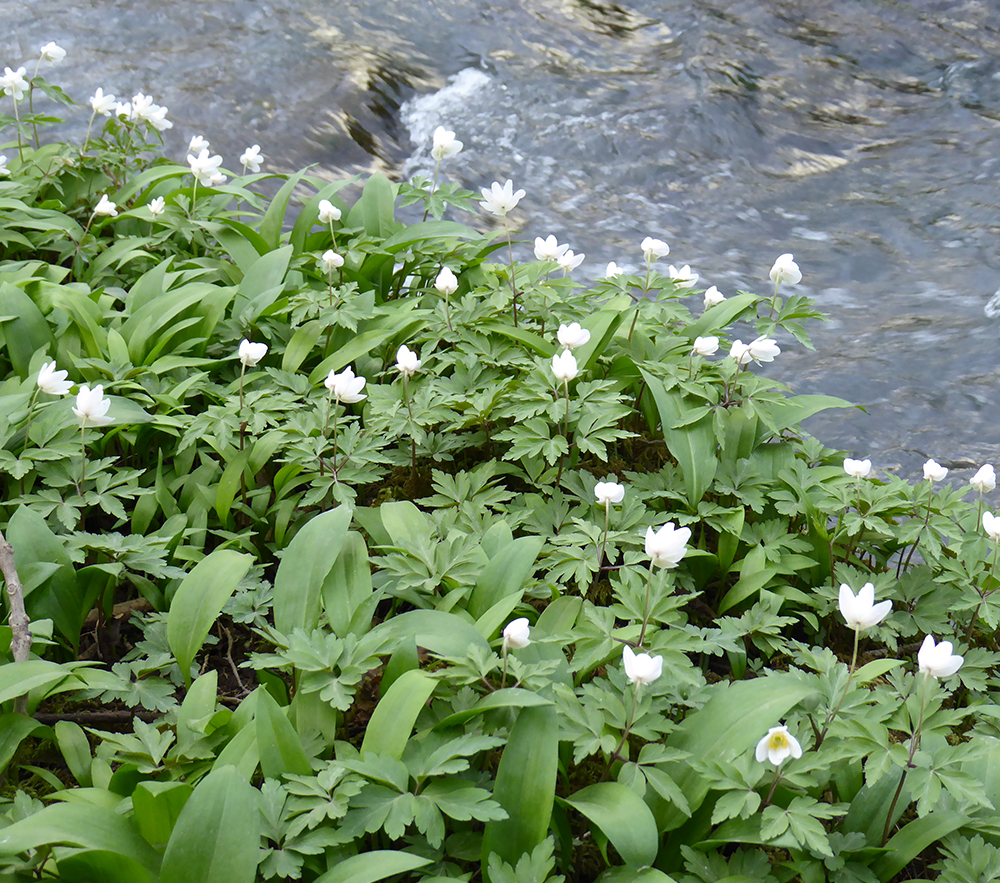
Wood Anemones
August 19, 2016 at 10:13 am
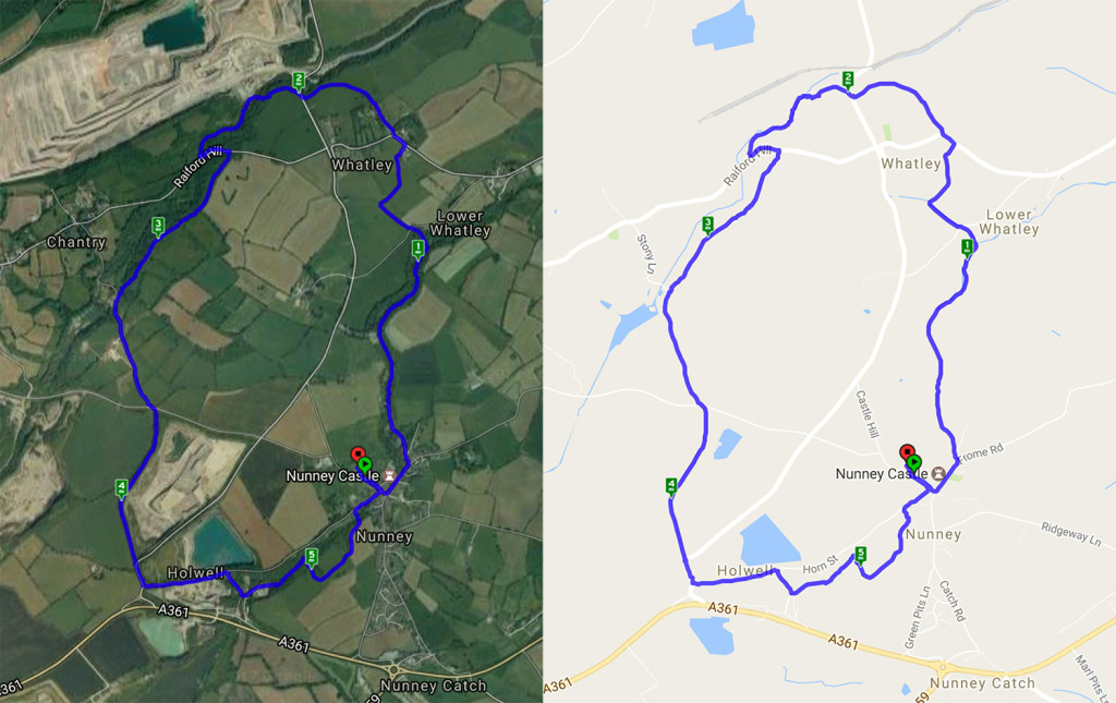
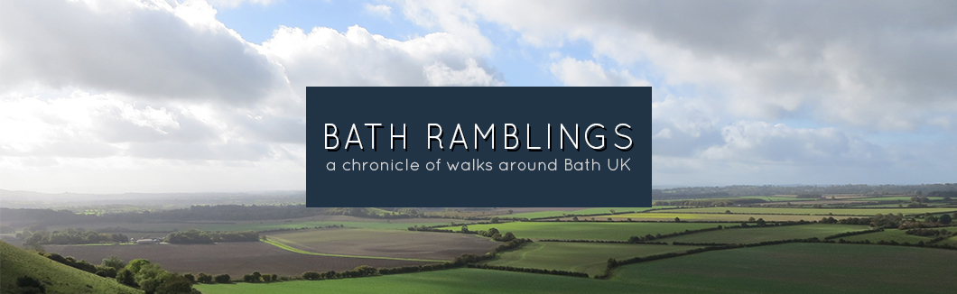
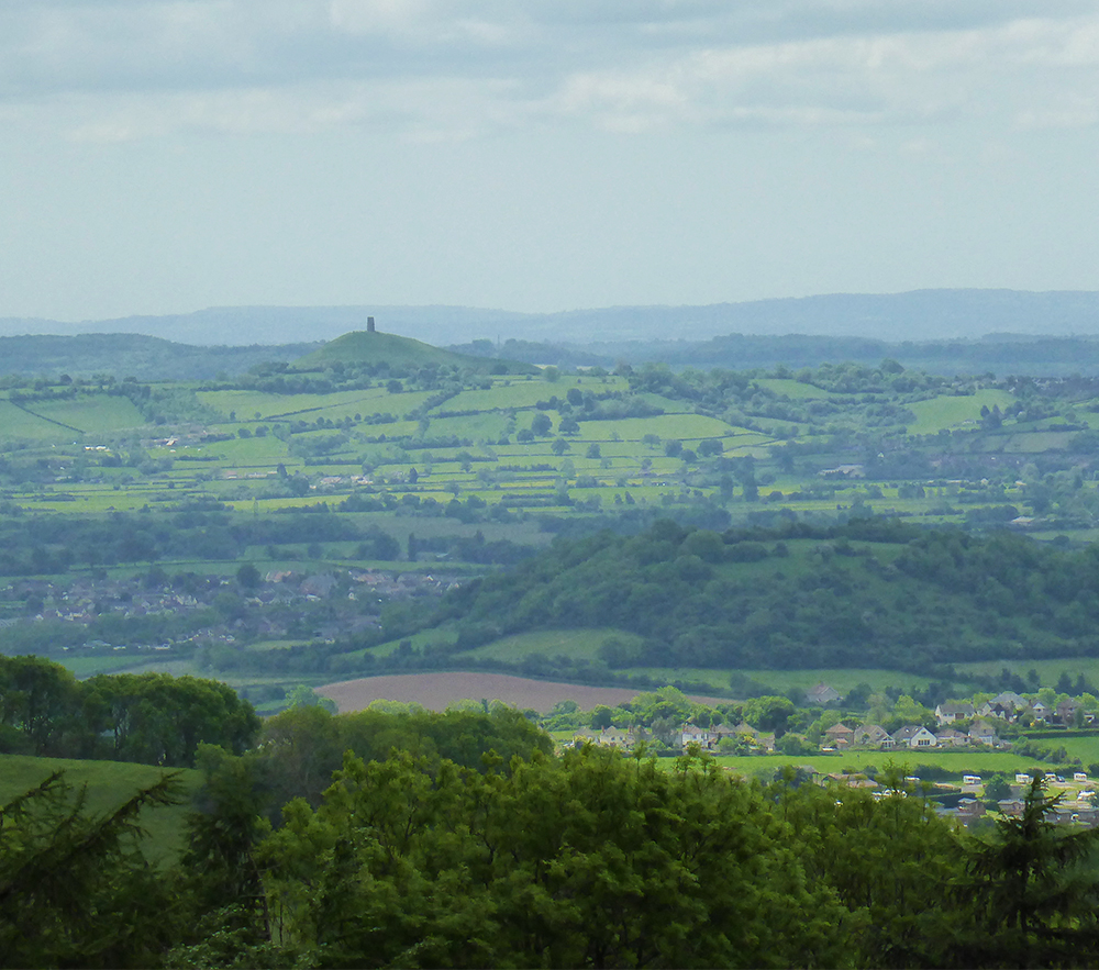
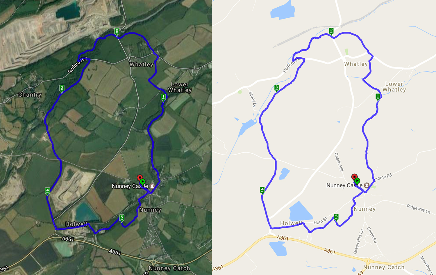
As promised Bath Ramblings is proud to present our first fully featured walk with detailed instructions – a 5.84 mile circular walk of average difficulty and varied environments. Starting from Nunney Castle Car park this walk quickly left the village and Nunney Brook was soon reached. A gentle walk through fields, along country lanes and streamsides. The quarries give an added interest to a very pleasant, varied walk. Nunney is a 40 minute drive from Bath going via Radstock and you can park in Castle Car Park.
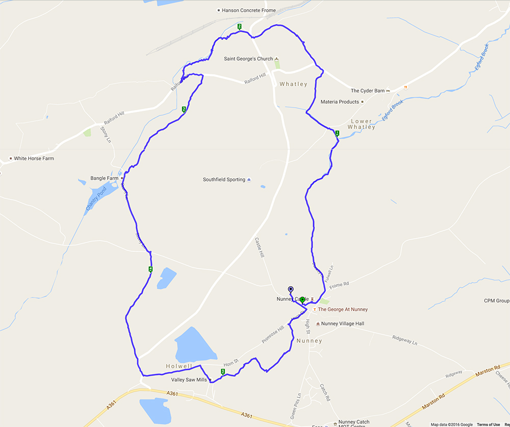
Route instructions:
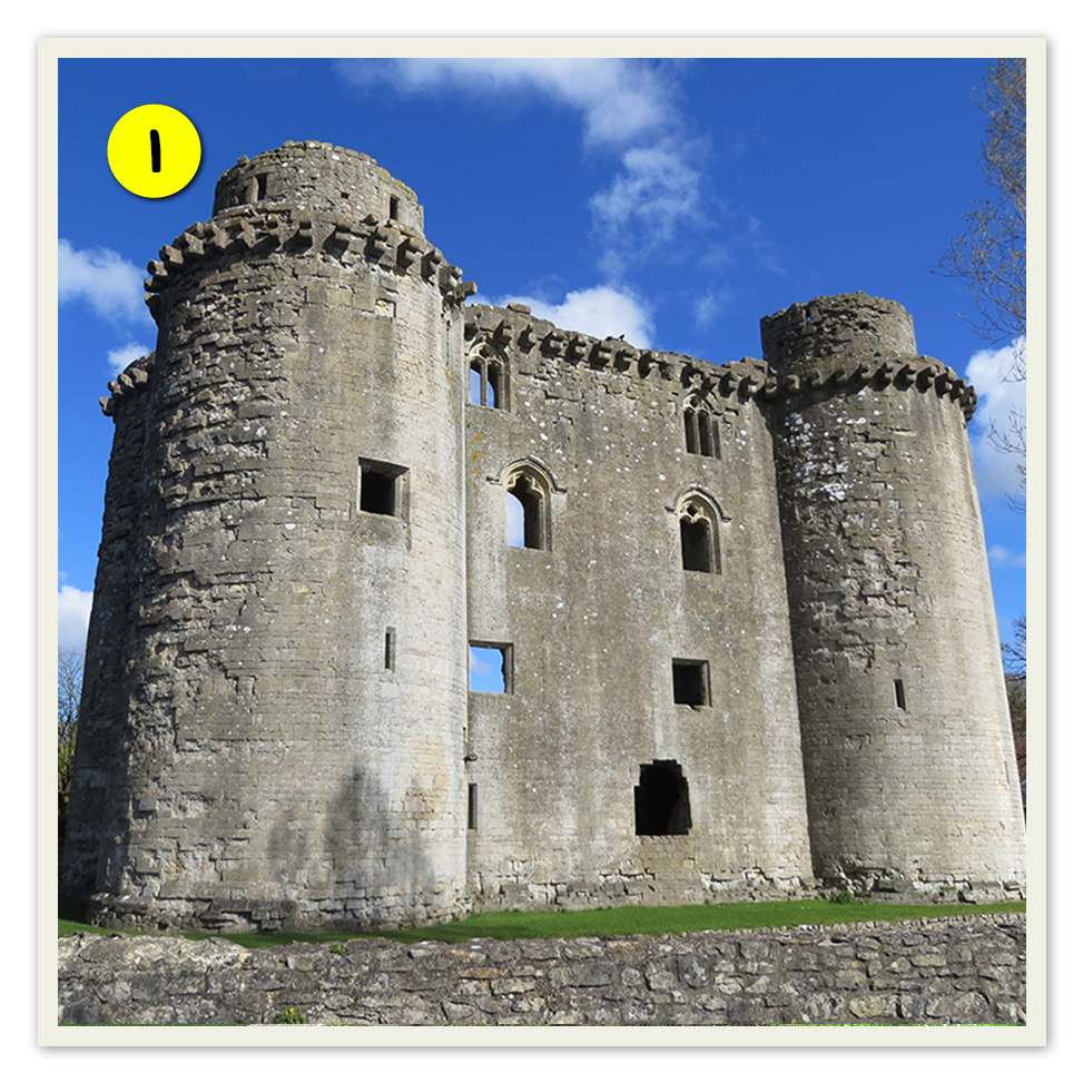
Turn left at the café to Nunney Castle. (PHOTO 1) If you look over the wall you will see the working moat.
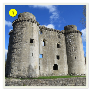
Nunney Castle
Recent Comments