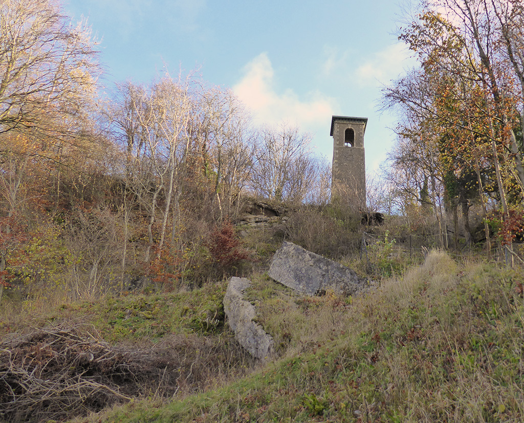
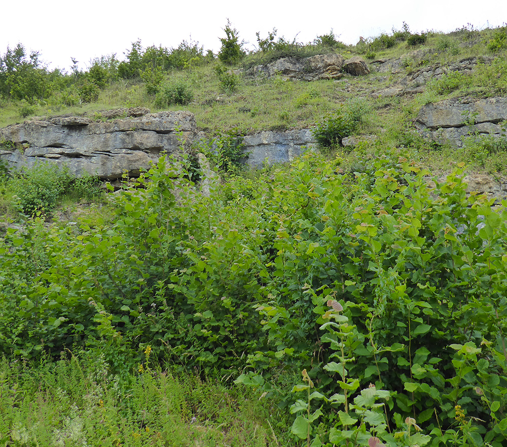
A regular favourite walk, this route starts from the village of Bathford and ascends steeply to Browne’s Folly before meandering through the woods of the nature reserve.
Browne’s Folly is a designated Site of Special Scientific Interest for wildlife and geology and is managed by Avon Wildlife Trust. You can find out more here
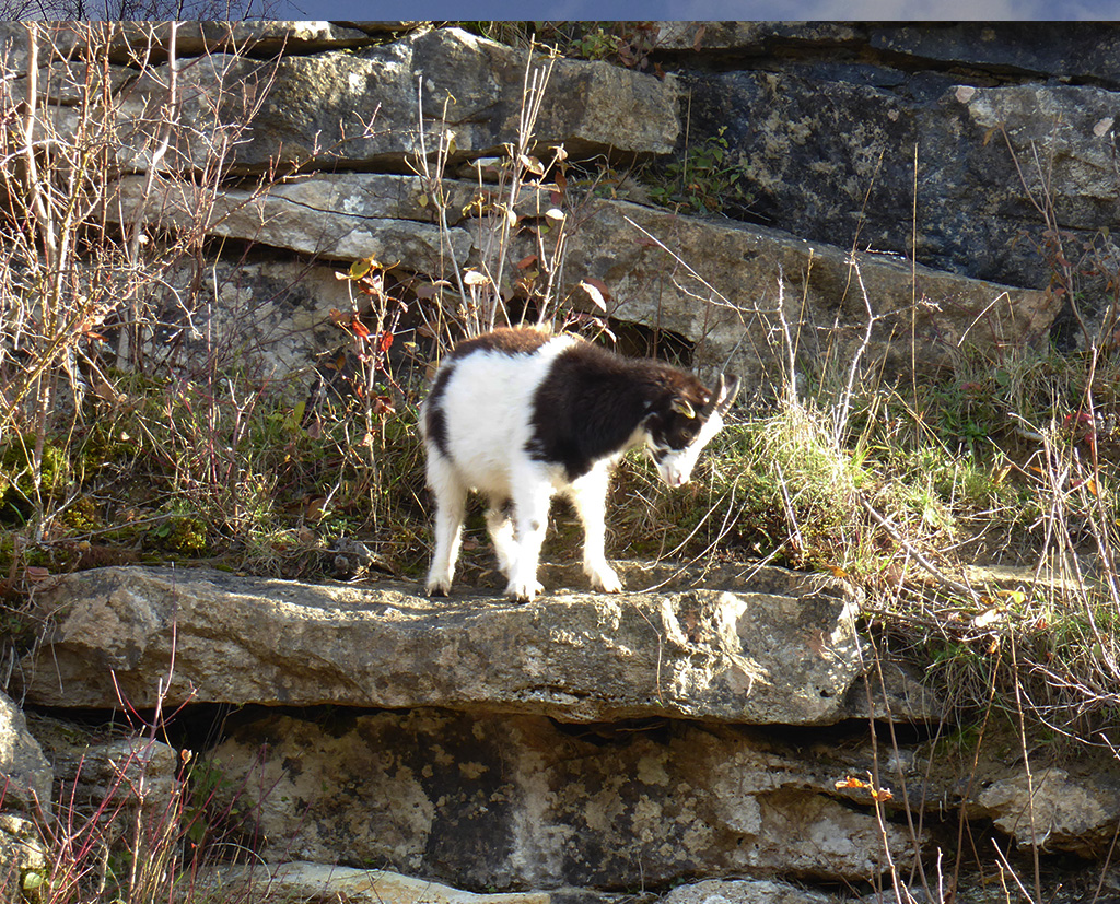
We regularly meet the friendly goats living near the tower and one of our photos was used on the cover of the Bathford Bulletin (September issue)
We’ll be leading this walk in January – why not join us. Details can be found on the Bath Ramblers website.
If the spooky stories about Sally in the Woods puts you off, be reassured that we heard birds tweeting cheerfully in the trees contradicting the myth of the silent woods!
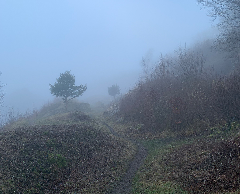
Our regular New Year trek up to Browne’s Folly and through the woods at Bathford. We first did this walk in January 2017 and it has become the traditional first walk of the year for Bath Ramblers.Two weeks ago when we pre-walked this route it was damp and foggy
This is one of our most familiar walks. It’s become a tradition to lead this route as the first one of the year with Bath Ramblers (you can see details in previous posts here, here and here. I’m pretty sure we did it in 2019 too but strangely there’s no write-up.) We are used to seeing it bare and chilly so it had quite a different feel overgrown with July foliage. The path through the nature reserve was clear though and the tracks were not too muddy considering the recent rains.
Sadly there were no goats around this time – unless they were hiding in the summer bushes.
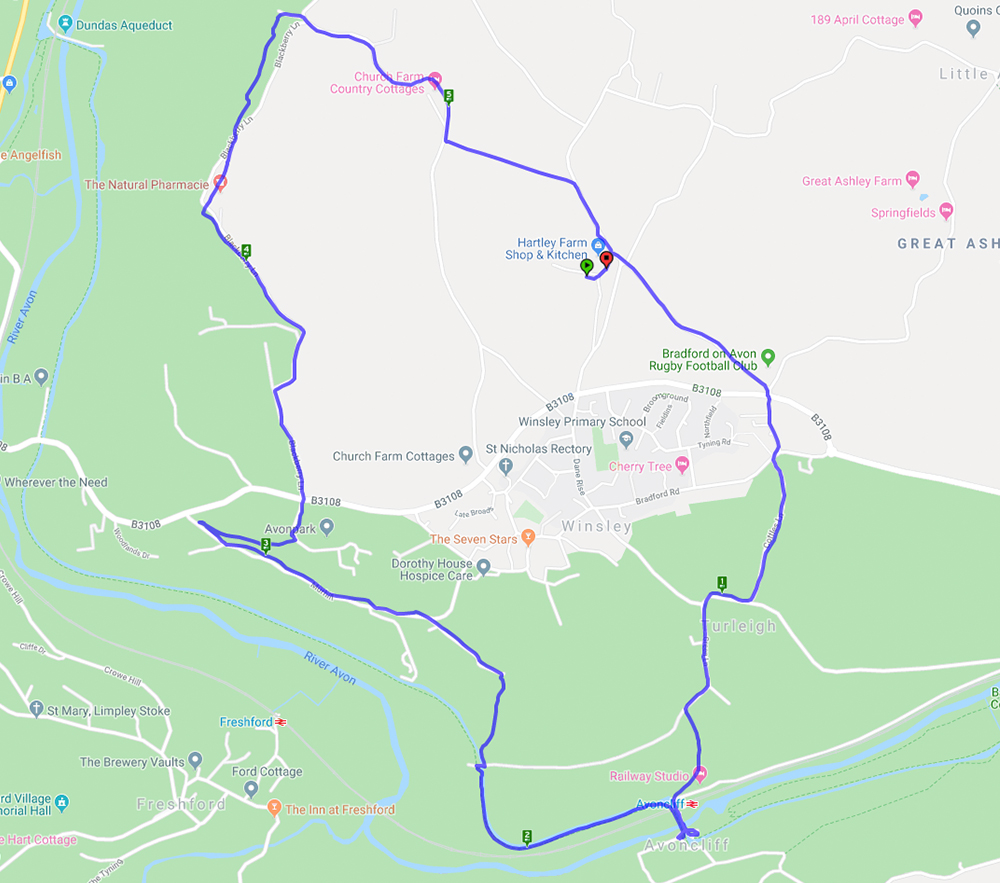
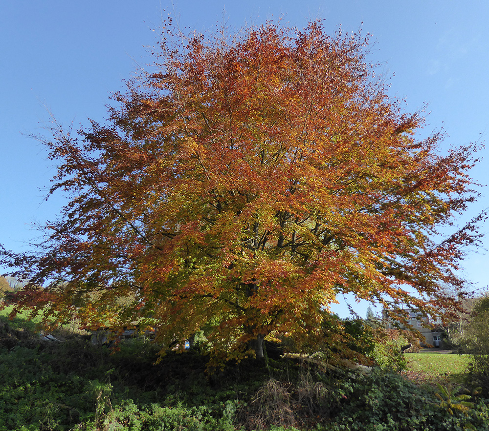
This walk started from Hartley Farm and went through Turleigh then down to the canal at Avoncliffe. The canal was a really peaceful spot for a brief coffee break. Then it was uphill through Murhill to Winsley and back to Hartley Farm via Conkwell. It was a lovely day of welcome autumn sunshine and the trees were in their full autumn colour against the clear blue sky.
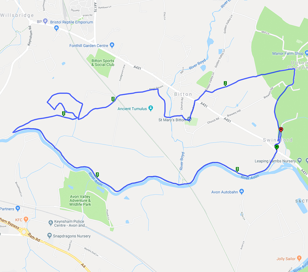
A lovely sunny Easter Sunday morning for a walk which started at Swineford before a gentle climb to Upton Cheyney and down to Bitton. After crossing the main road the path went through a grove, which was a good place for lunch, and down to the River Avon for the return to Swineford. It was interesting to note the old boat building (now repair) premises on the edge of Keynsham and the number of boats on the river.
Monkton Farleigh – a repeat of the 2016 Spring Walk here It’s interesting to note that the pub mentioned in the previous post has changed – read all about it here
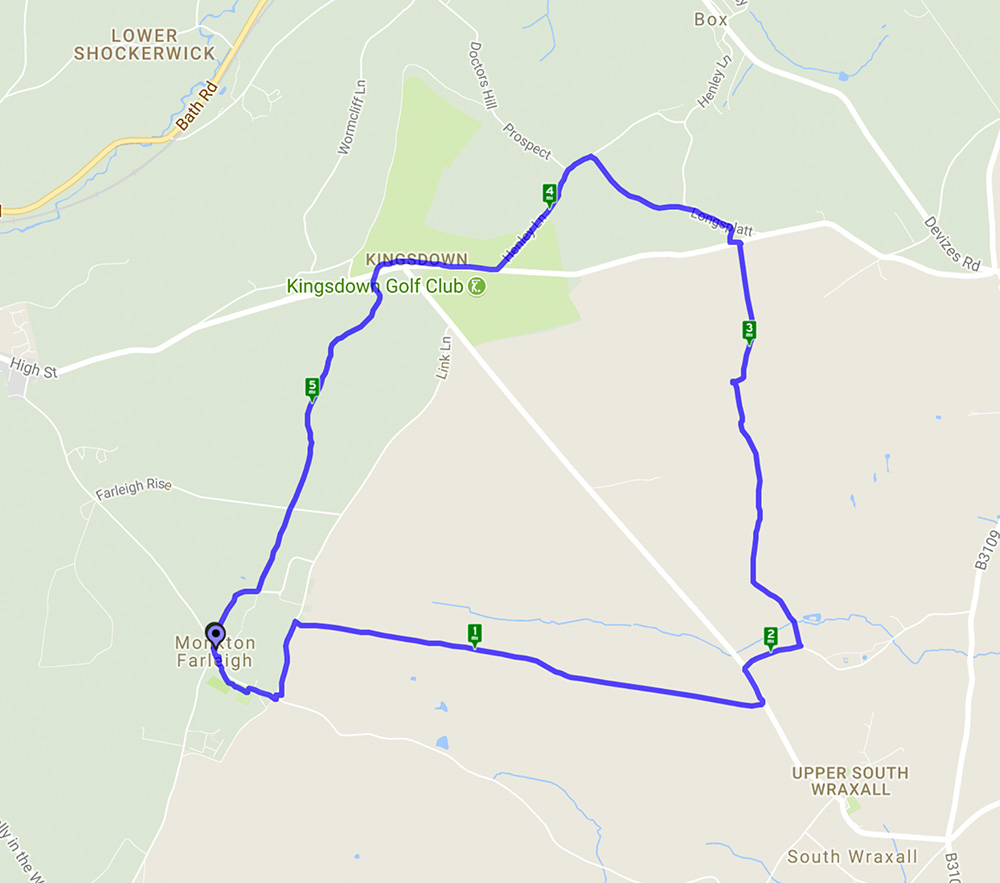
This walk, starting from Monkton Farleigh, was a repeat of that done on 20 March 2016 so much of the detail remains the same. It was however good to see the autumn scenery rather than the spring version. Many of the trees still had their autumn leaves but those which didn’t revealed their structure against the clear blue sky. One bit of excitement was entering a field of cows and calves and then realising the bull was close to the path. Fortunately he seemed more interested in chewing the cud than attacking an innocent group of walkers.
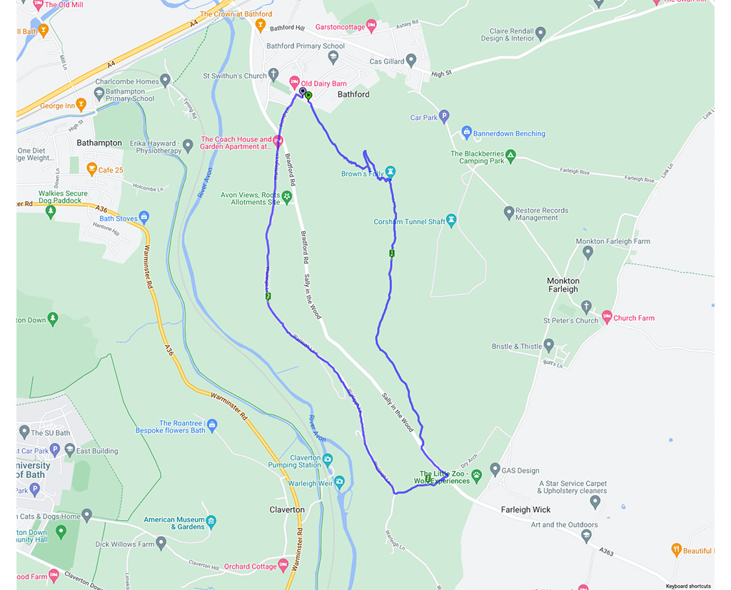
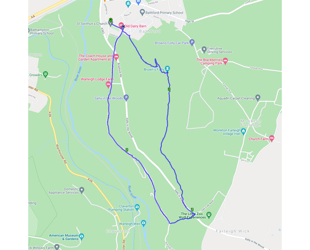
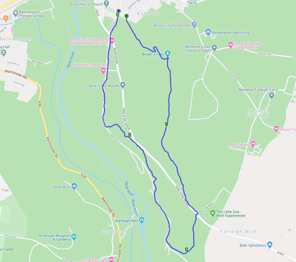
A 5.8 mile circular walk starting and ending at Monkton Farleigh
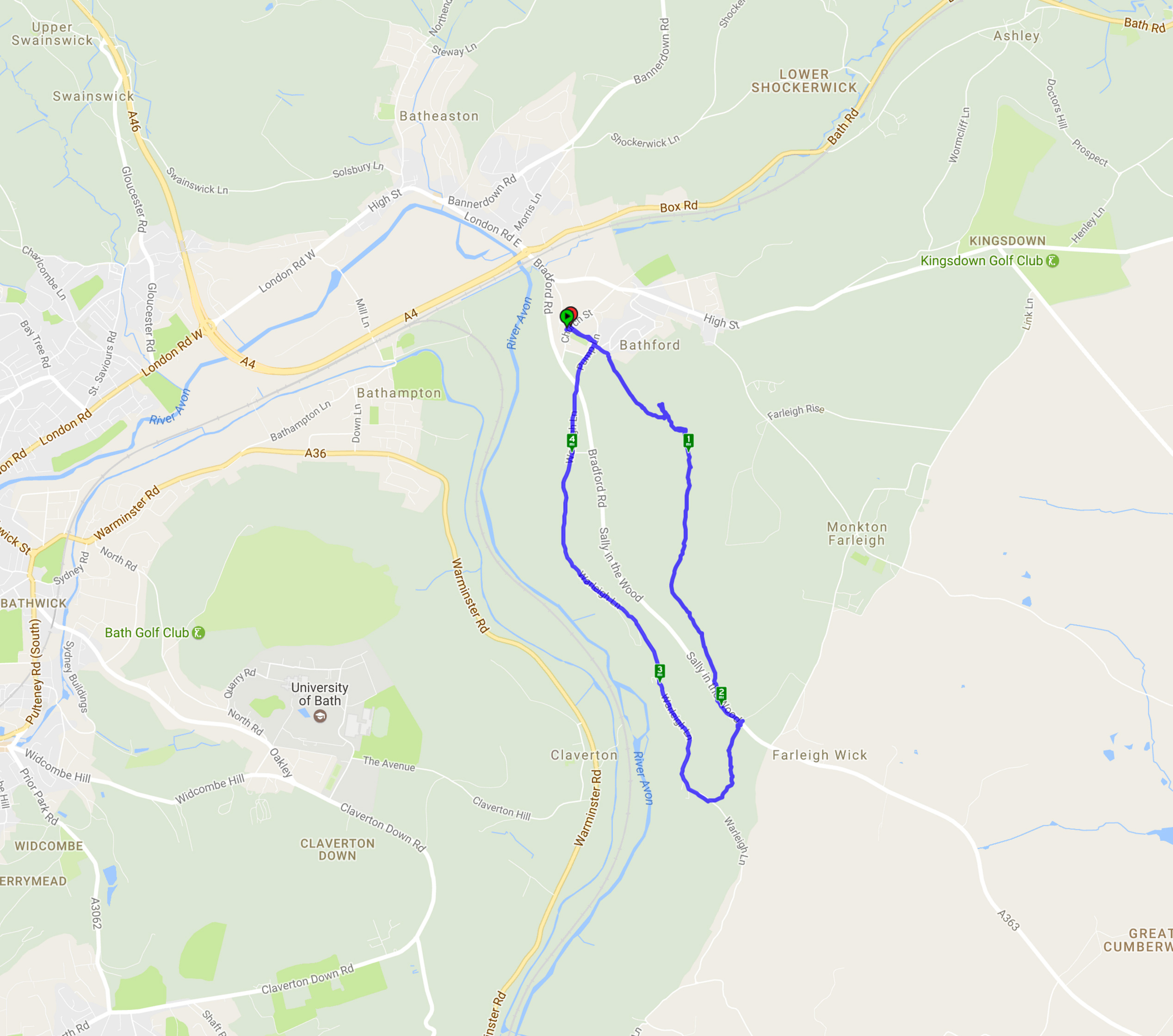
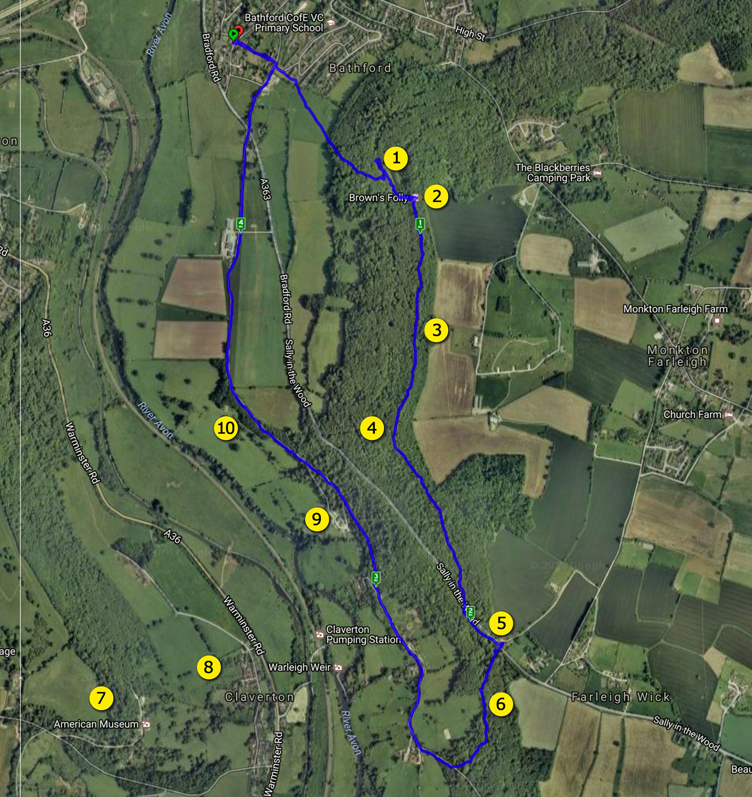
Happy New Year from Bath Ramblings. We are pleased to offer you our second fully featured walk which is a 4.5 mile (approx) circular hike starting and ending at St Swithin’s Church Bathford.
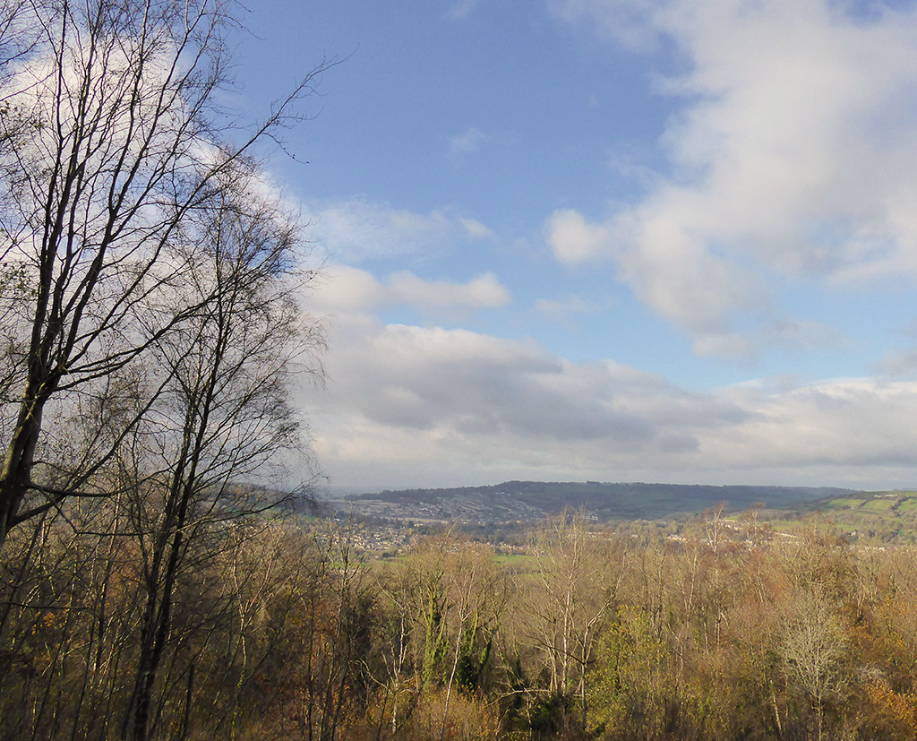
‘This very pleasant walk (thanks to Nigel Vile) started from St Swithun’s Church in Bathford before starting a steep climb up to Brown’s Folly. Following a pause to recover it was a gentle walk through the Nature Reserve down to the main road then a brief walk before descending under the road via the dry arch. Another gentle – if muddy – path led to the Conkwell to Bathford lane and finally back to the church. On a clear day the views across to Claverton are wonderful – sadly this wasn’t one of those days. A pleasant walk through fields and woodland and along a country lane gave a variety of scenery.’
map
satellite
Starting at St Swithin’s church walk down the narrow alleyway to the left of the graveyard. When you emerge cross over the road and cross the green to the right of the houses until you come to a stile (there is a sign warning of cows in the field, the herd we came across were pretty docile) From now on the path is an upward climb until you get to the tower.
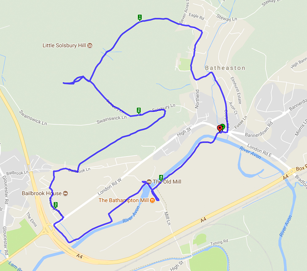
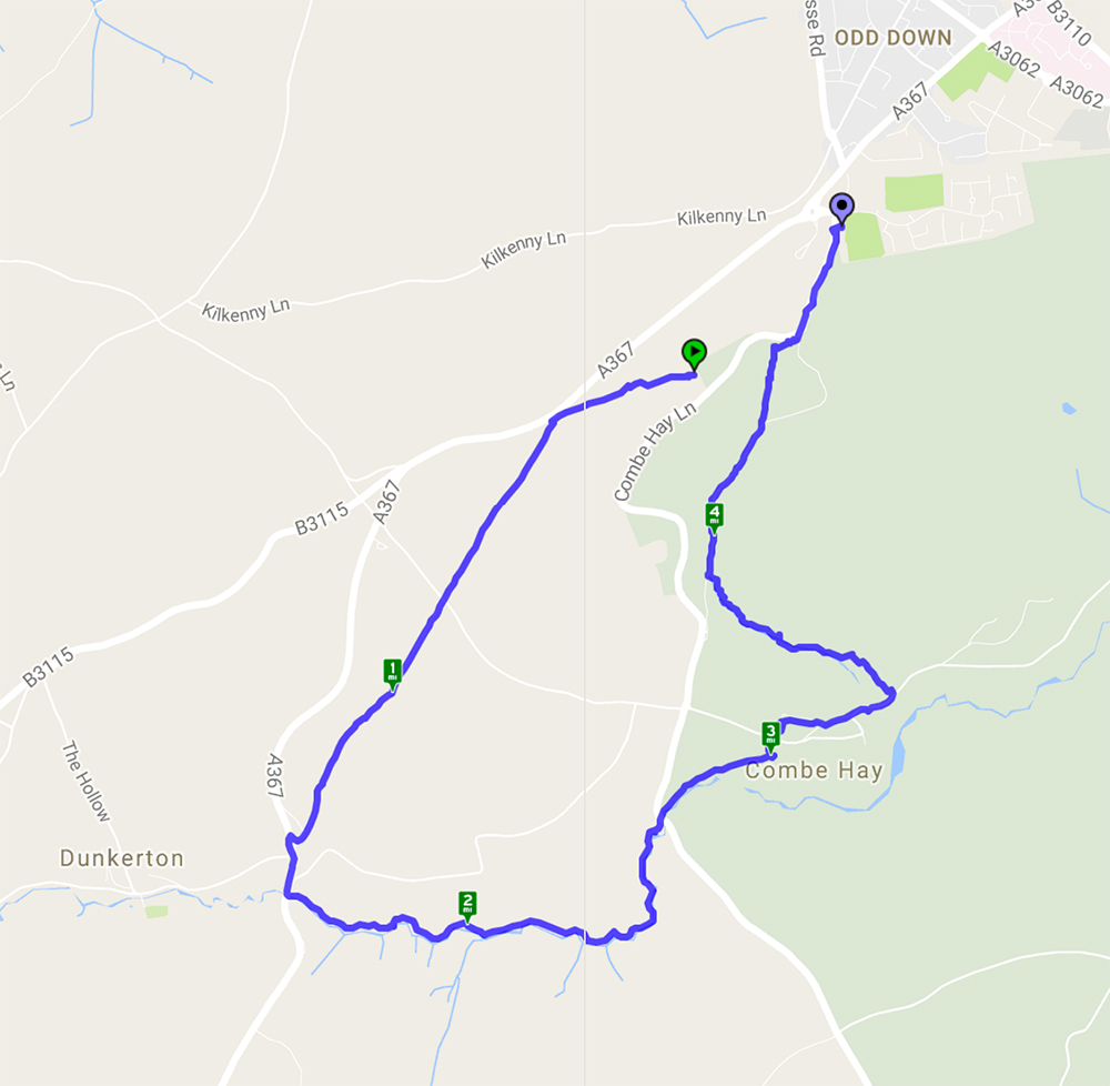
An approximately 5 mile walk starting and ending near Odd Down Park-and-Ride. This walk started from Odd Down Football Club on a chilly August morning. After a short walk along Combe Hay Lane the tarmac was left behind for fields, woodland and brook side paths down to Dunkerton and back through Combe Hay. Although it was August there was still a surprising variety of wild flowers and the blackberries and sloes were ripening well. A varied walk which at times gave stunning views followed by tree lined paths in total shade.
(the walk does start and end at the same place – the football club carpark – I just forgot to set the tracker going straight away!)
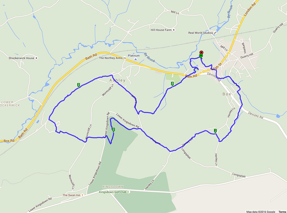
This walk started from Selwyn Hall car park and went through part of Box – where there is a house called The Old Sweet Factory although no details are known about its history. Crossing the High Street the walk went through Henley then cut across Kingsdown Golf Course before returning through Ashley. It was a glorious day with lovely summer views across the rolling Wiltshire country side and the drinks break in a wonderful flower meadow was just like old times.
Thank you for visiting Bath Ramblings. Here you will find information and photos from a variety of walks around the South West. Most of these walks are organized by the Bath Ramblers – find out more on the ‘about’ page.
The maps are meant as a rough guide, if you click on the ‘walkmeter’ buttons on each post you can get more information including a satellite map.
Don’t forget to click on the ‘read more’ button at the bottom of each post for more photos.

Recent Comments