January 28, 2018 at 6:24 pm
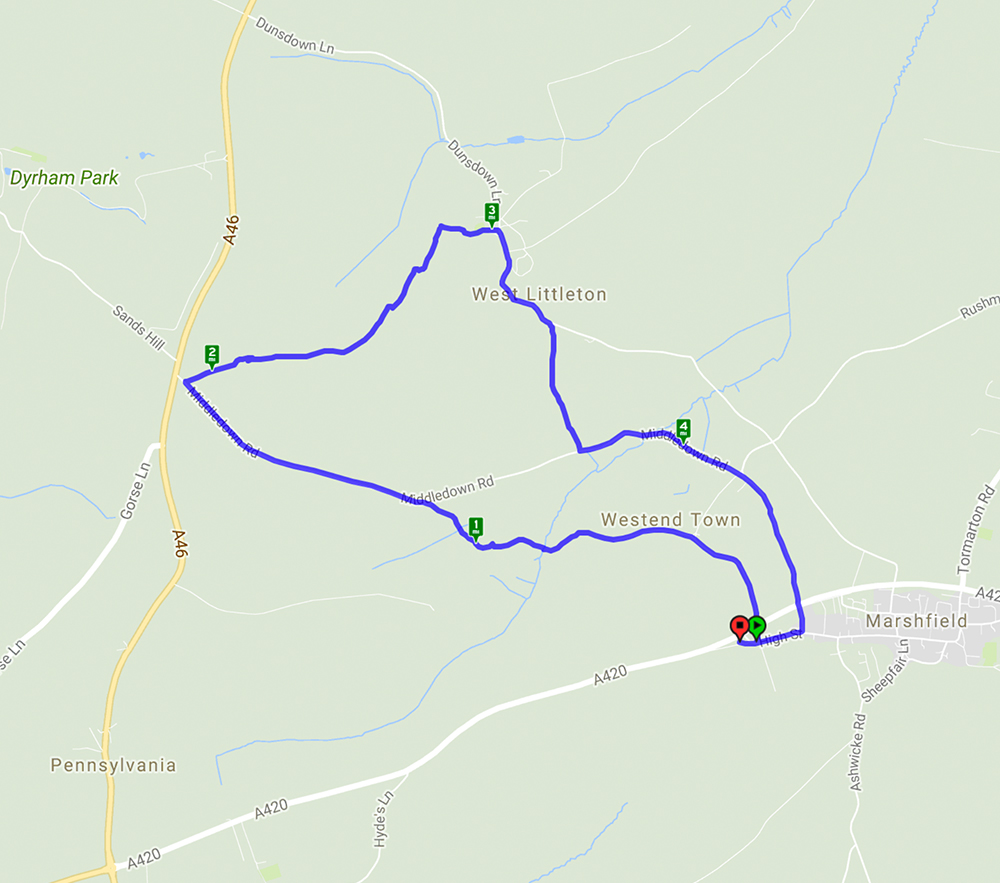
A 4.8 mile walk starting and ending in Marshfield Village
This walk started in the village of Marshfield and after crossing the A420 it followed lanes and footpaths across very muddy fields to reach the village of West Littleton with its very attractive church with a 13th century turret and bellcote. The return to Marshfield passed Castle farm with its turreted farmhouse – very unusual. The views over the rolling Cotswold hills were something of a teaser given the mist and low cloud but on a clear day would have been spectacular.

January 11, 2018 at 10:14 am
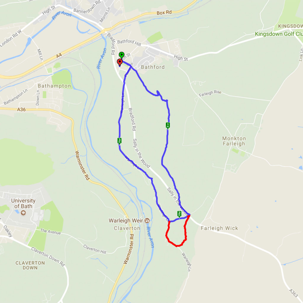
Browne’s Folly Revisited – 7.1.18
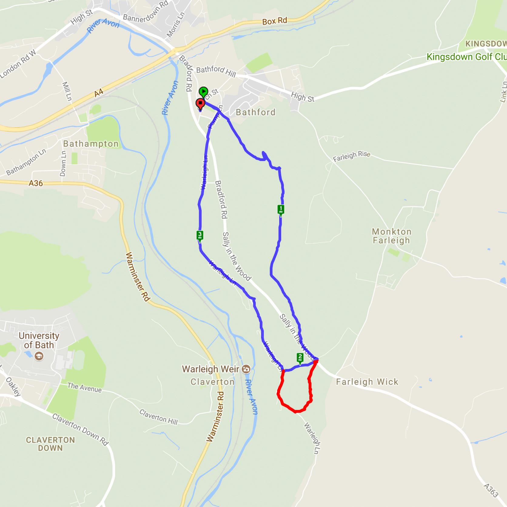
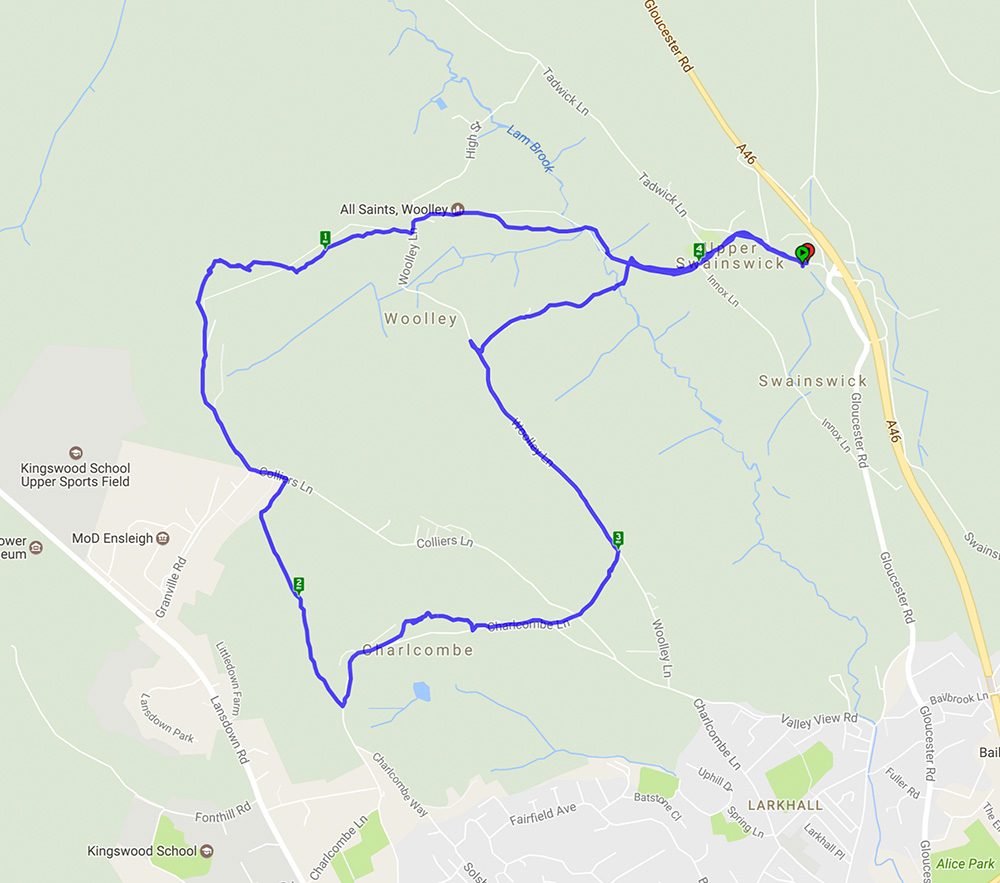
A cold but very sunny morning made the ideal conditions for this walk. Starting from Bathford, a steep climb led through woods to Browne’s Folly before descending through the reserve and heading back to Bathford. A slight variation in the route from the previous walk here avoided the very muddy bridleway and was a pleasant, shorter path. The clear skies gave excellent views.
The map below shows today’s route in blue including the shortcut – the extra red bit is the part of the original route that can be circumvented if the path is particularly muddy. You can see details of the last time we did this walk here.
November 13, 2017 at 12:01 pm
Monkton Farleigh – a repeat of the 2016 Spring Walk here It’s interesting to note that the pub mentioned in the previous post has changed – read all about it here
This walk, starting from Monkton Farleigh, was a repeat of that done on 20 March 2016 so much of the detail remains the same. It was however good to see the autumn scenery rather than the spring version. Many of the trees still had their autumn leaves but those which didn’t revealed their structure against the clear blue sky. One bit of excitement was entering a field of cows and calves and then realising the bull was close to the path. Fortunately he seemed more interested in chewing the cud than attacking an innocent group of walkers.
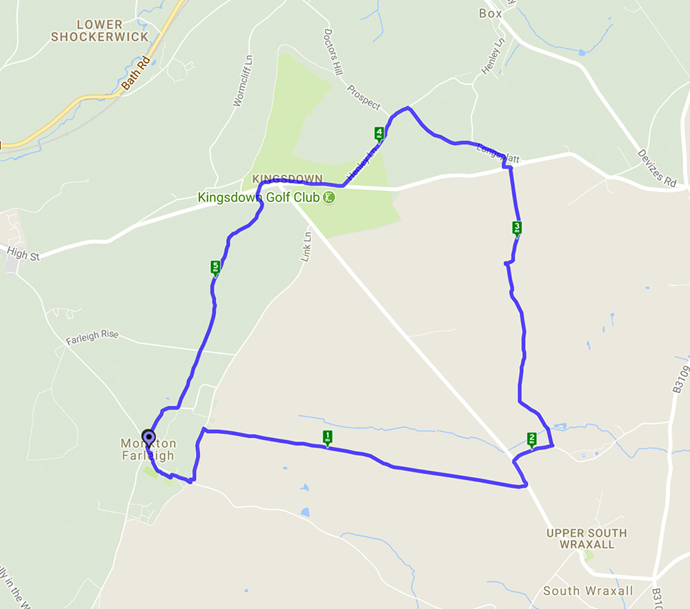
A 5.8 mile circular walk starting and ending at Monkton Farleigh
August 13, 2017 at 4:54 pm
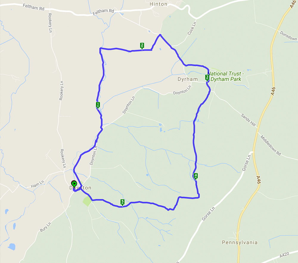
A 5.5 mile walk starting and ending in Doynton
This walk started from the car park of the sadly closed pub in Doynton and went through woods and fields before skirting Dyrham Park and heading back to Doynton. The steep hills were well worth the effort as, combined with glorious weather, the reward was far reaching views stretching as far as the Severn bridge.
August 2, 2017 at 9:08 am
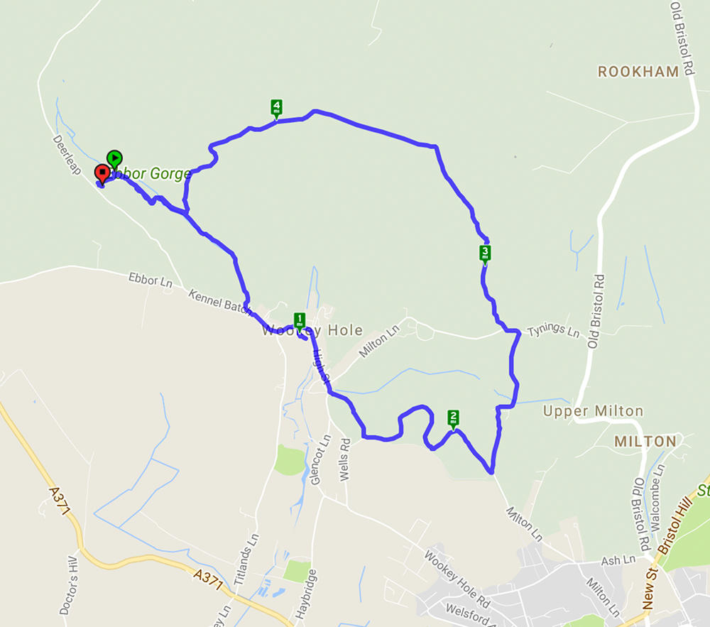
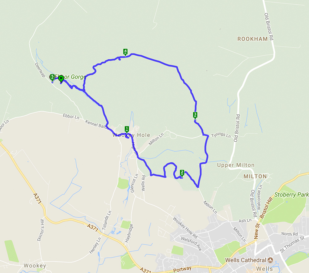
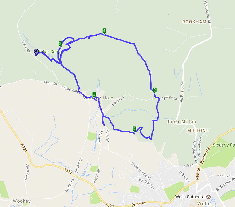
Welcome to our third featured walk which is a 4.9 mile circular hike through Ebbor Gorge on the West Mendip Way. Full instructions are below.
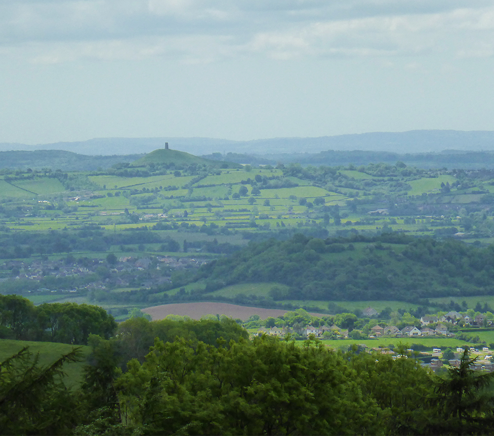
This walk starts from Ebbor Gorge car park and heads down into the reserve before diverting into Wookey Hole village. From there it goes across fields and through woods before returning to the nature reserve and back to the car park. A challenging walk with steep flights of steps and climbs up hills but well worth the effort for the far reaching views across the Somerset countryside. The limekilns and rock formations are an interesting addition.
April 17, 2017 at 10:14 am
Westbury White Horse – A 5.9 mile walk starting and ending at the White Horse car park.
The walk started from the Westbury White Horse car park and went past the old chalk quarry and skirted Imber Range – no firing today! The mostly level walk from high ground gave wonderful long distance views. Paragliders and kite flyers were taking advantage of the wind. Animal highlights included a Peregrine Falcon, skylarks, very woolly brown sheep and shaggy ponies – and, of course, the White Horse. An avenue of Beech trees provided the ideal setting for coffee and Easter Eggs!
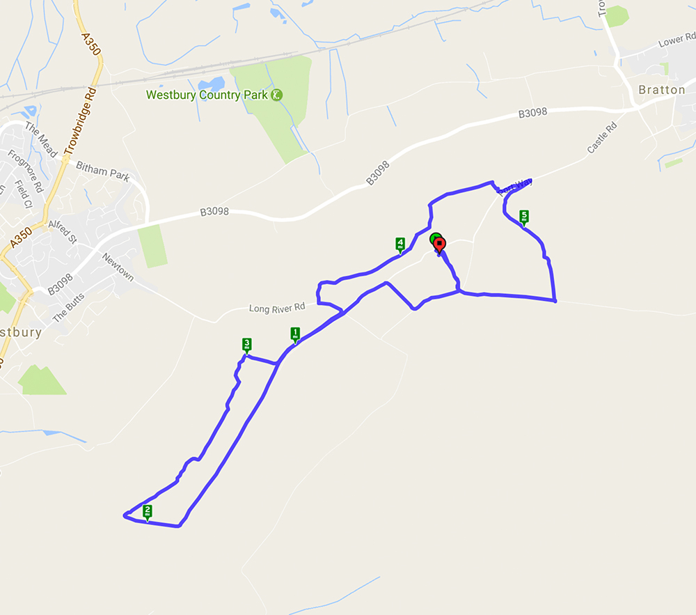
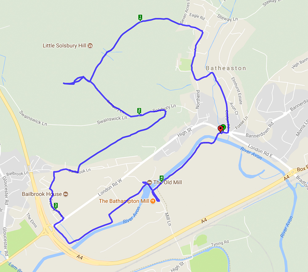
map
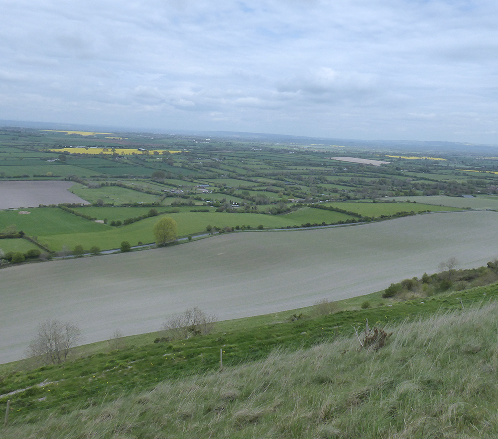
undulating fields
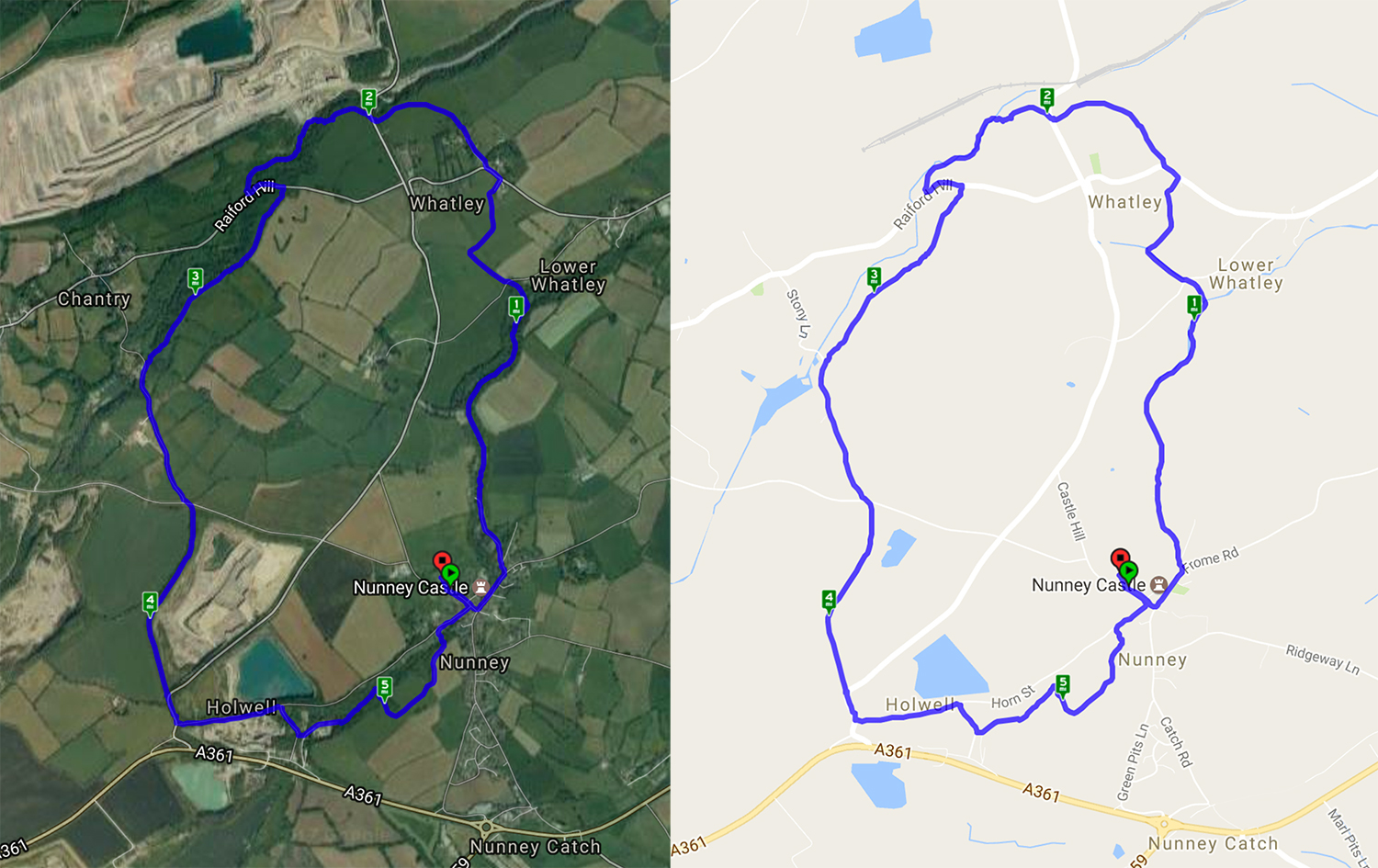
March 28, 2017 at 6:25 am
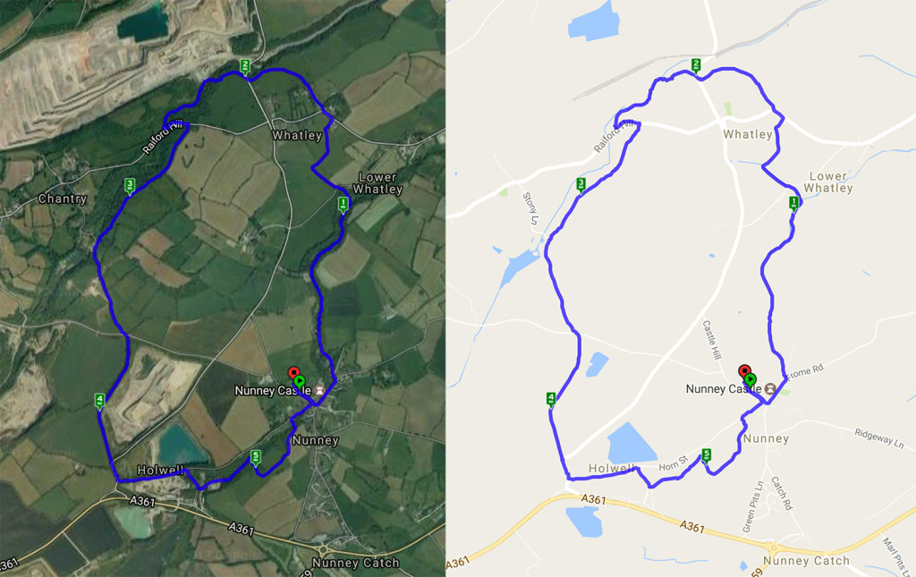
On a gloriously sunny spring day it was well worth repeating this walk – see walk on 31/7/16 – as the differences were clear. The views were spectacular and the wood anemones and primroses were flourishing along the stream side paths although the wild garlic had yet to flower. The absence of leaves improved the views and gave a clear impression of how large the quarry was!
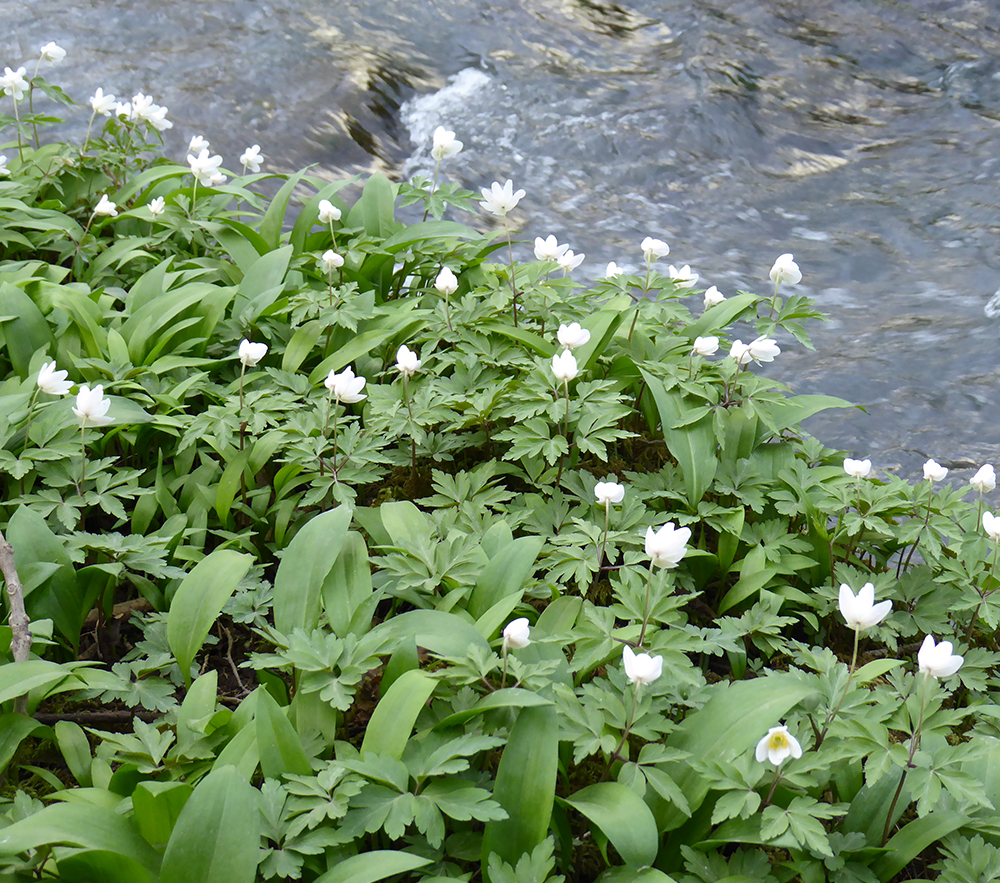
Wood Anemones
Recent Comments