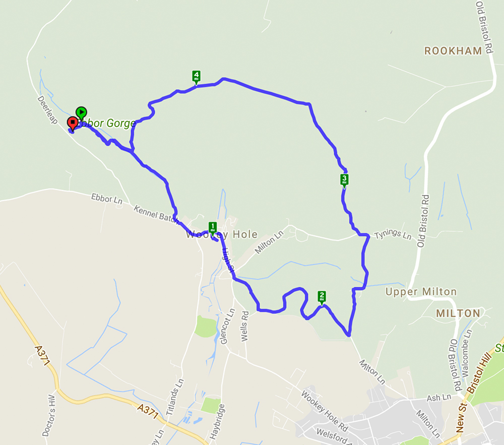
Welcome to our third featured walk which is a 4.9 mile circular hike through Ebbor Gorge on the West Mendip Way. Full instructions are below. This walk starts from Ebbor Gorge car park and heads down into the reserve before diverting into Wookey Hole village. From there it goes across fields and through woods before returning to the nature reserve and back to the car park. A challenging walk with steep flights of steps and climbs up hills but well worth the effort for the far reaching views across the Somerset countryside. The limekilns and rock formations are an interesting addition.
Route Details
View Route on Walkmeter (opens in a new tab)There are plenty of pictures of this walk on previous posts here and here so just a couple more.
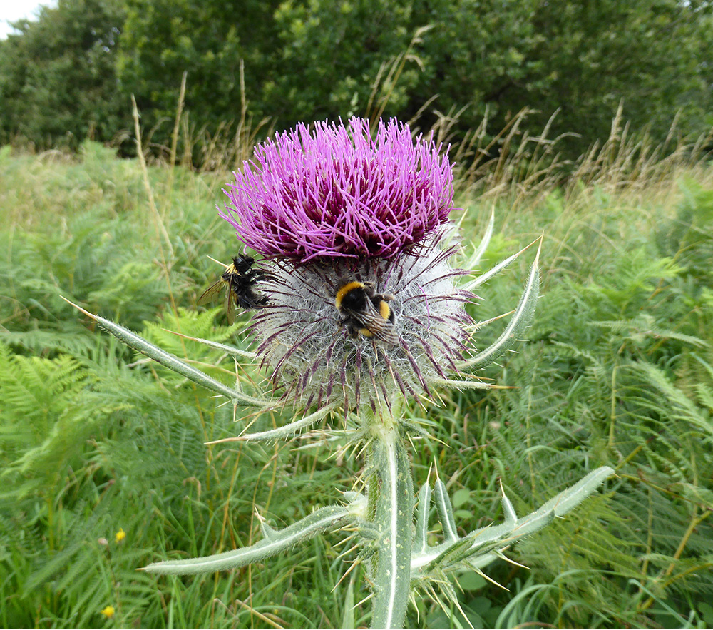 We saw plenty of bees and butterflies around today and they seem to love these impressive Wooly Thistles
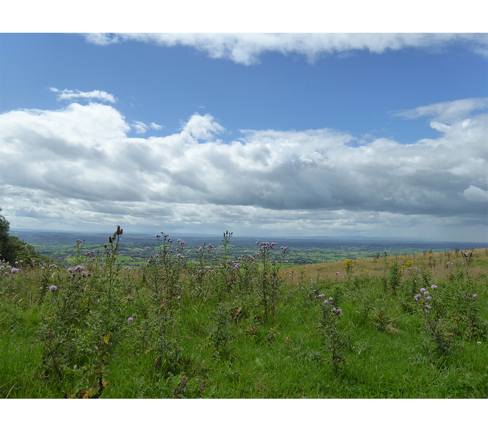
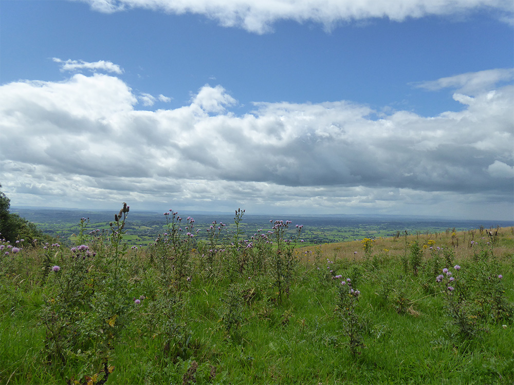 The views on this walk are always impressive and can look completely different depending on the weather.
Driving Instructions from Bath
Take A39 signposted Wells, through Chewton Mendip, then about a mile after the Green Ore crossroads turn right to Priddy. In Priddy turn left (signposted Deerleap there is a pub almost immediately on the right) and go on until you reach the entrance to Ebbor Gorge car park on the left.
Walk directions
- From the notice board at the top end of the car park descend a stepped path. After a clearing, turn left, signposted “The Gorge”. The wide path crosses the stream to another junction.

- Turn right, away from the gorge down the valley to a road. Turn left, to pass through Wookey Hole village. At its end the road bends right; take a kissing gate on the left with a “West Mendip Way” post. After two more kissing gates turn left up a spur to a stile and the top of Arthur’s Point.

- Bear right for 60 yards into woods again. Beware: hidden in the brambles ahead is the top of a quarry crag. So, turn right, down to a stile. Go down the field edge to a kissing gate and bear left between boulders back into the wood. Pass between high quarry crags and after a sharp little rise bear right, contouring to join Lime Kiln Lane below. This bends left with, again, a path on the left diverting through the bottom of the wood. This emerges at the end of a short field track, which is followed down to a footpath signpost. N.B. waymarker post standing in a stone plinth.

- Turn sharp left, on to a tarred track that bends right then left through Model Farm to Tynings Lane. Turn left for 85 yards to a signposted stile on the right. Go up with a fence on your right, then bear left to a gate with a stile. Go straight up the next field, aiming for a gateway below the top left corner with tractor ruts running unto it. A track leads up through a wood and a field. From the gate at its top slant upwards in the same direction to another gate next to a stile 100 yards below the field’s top left corner.

- A faint path runs along the tops of three fields with a long view across the Levels away to your left. With a stile on the right and a gate and horse trough in front, turn downhill keeping the fence on your right; follow it to a stile leading into the Ebbor Gorge Nature Reserve.

- A second gate leads into a wood. Carry on down the stepped path through the woods until you come to a junction, turn right and carry on following the signs to the car park. This will lead you back to the bottom of the steps which started the walk.
Additional Photos