November 12, 2018 at 10:25 am
A lovely day for a walk – clear blue skies and sunshine was a real November treat. The walk started from Newbridge Park and Ride and, after crossing the A4, went along footpaths to Newton St Loe before going through the grounds of Bath Spa University. One of the lakes provided a quiet spot for lunch before returning across the A4, under the railway line and along the cycle path to the start.
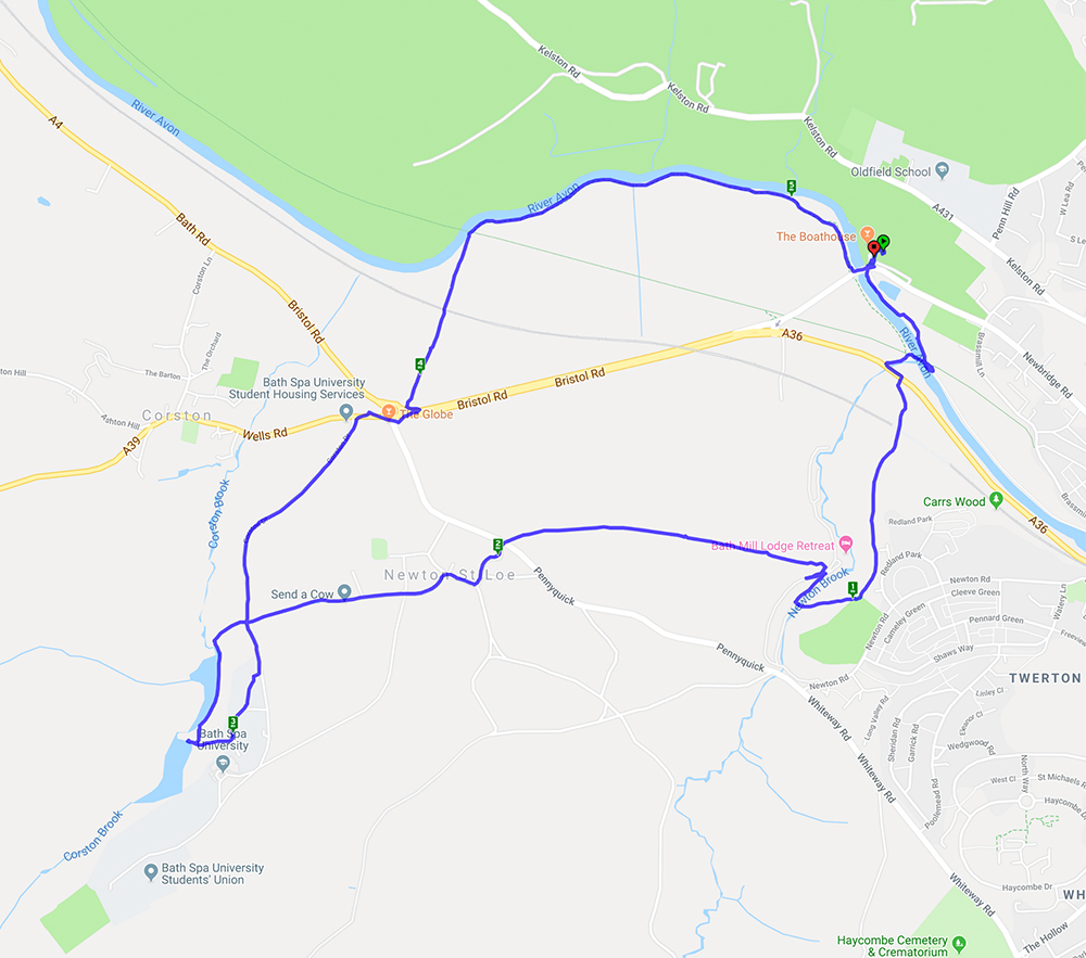
A 5.2 mile walk starting and ending at Newbridge Park-and-Ride

July 23, 2018 at 11:16 am
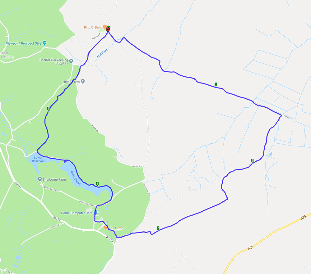
A nearly 6 mile walk starting and ending at the Ring O Bells pub in Hinton Blewett.
This circular walk started in Hinton Blewett on a gloriously warm morning. The fields were brown and the mud had solidified which made for interesting walking. Fortunately there were also some shady lanes and wooded paths. The walk went through the lovely little village of Litton where the reservoirs provided a good lunch stop and the opportunity to watch the birds on the water.
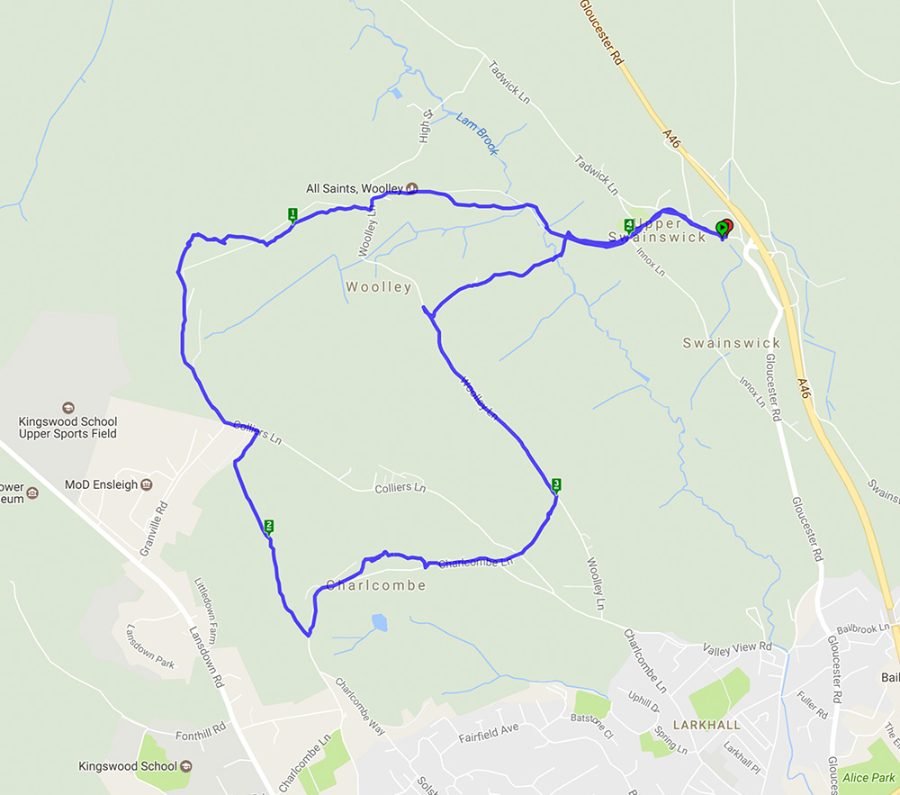
April 23, 2018 at 9:20 am
This is a walk we have done before here and here. It’s 5 miles with lots of hills (and views on a good day) and woodland.
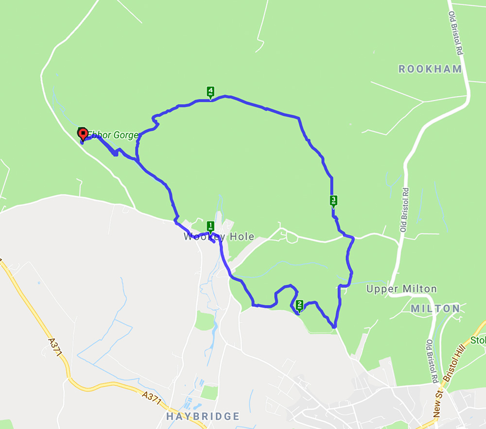
This walk started from Ebbor Gorge car park and went down to the reserve by a steep flight of steps before levelling out for the walk to Wookey Hole village. At the end of the village a path led across fields to Arthur’s Point – good views in all directions. After a stroll through woods another series of hills gave spectacular views across the Somerset levels before returning to the reserve and back to the car park. A lovely spring day with primroses, anemones, bluebells and lambs aplenty.
January 28, 2018 at 6:24 pm
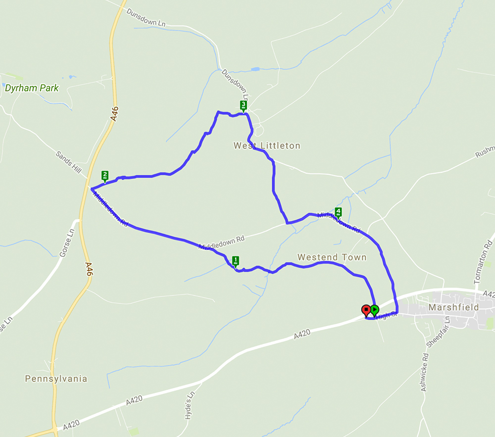
A 4.8 mile walk starting and ending in Marshfield Village
This walk started in the village of Marshfield and after crossing the A420 it followed lanes and footpaths across very muddy fields to reach the village of West Littleton with its very attractive church with a 13th century turret and bellcote. The return to Marshfield passed Castle farm with its turreted farmhouse – very unusual. The views over the rolling Cotswold hills were something of a teaser given the mist and low cloud but on a clear day would have been spectacular.
November 13, 2017 at 12:01 pm
Monkton Farleigh – a repeat of the 2016 Spring Walk here It’s interesting to note that the pub mentioned in the previous post has changed – read all about it here
This walk, starting from Monkton Farleigh, was a repeat of that done on 20 March 2016 so much of the detail remains the same. It was however good to see the autumn scenery rather than the spring version. Many of the trees still had their autumn leaves but those which didn’t revealed their structure against the clear blue sky. One bit of excitement was entering a field of cows and calves and then realising the bull was close to the path. Fortunately he seemed more interested in chewing the cud than attacking an innocent group of walkers.
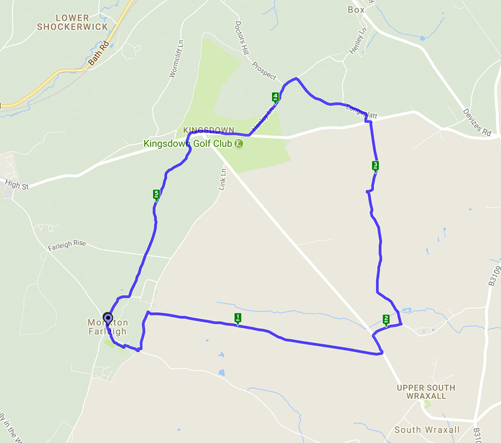
A 5.8 mile circular walk starting and ending at Monkton Farleigh
August 13, 2017 at 4:54 pm
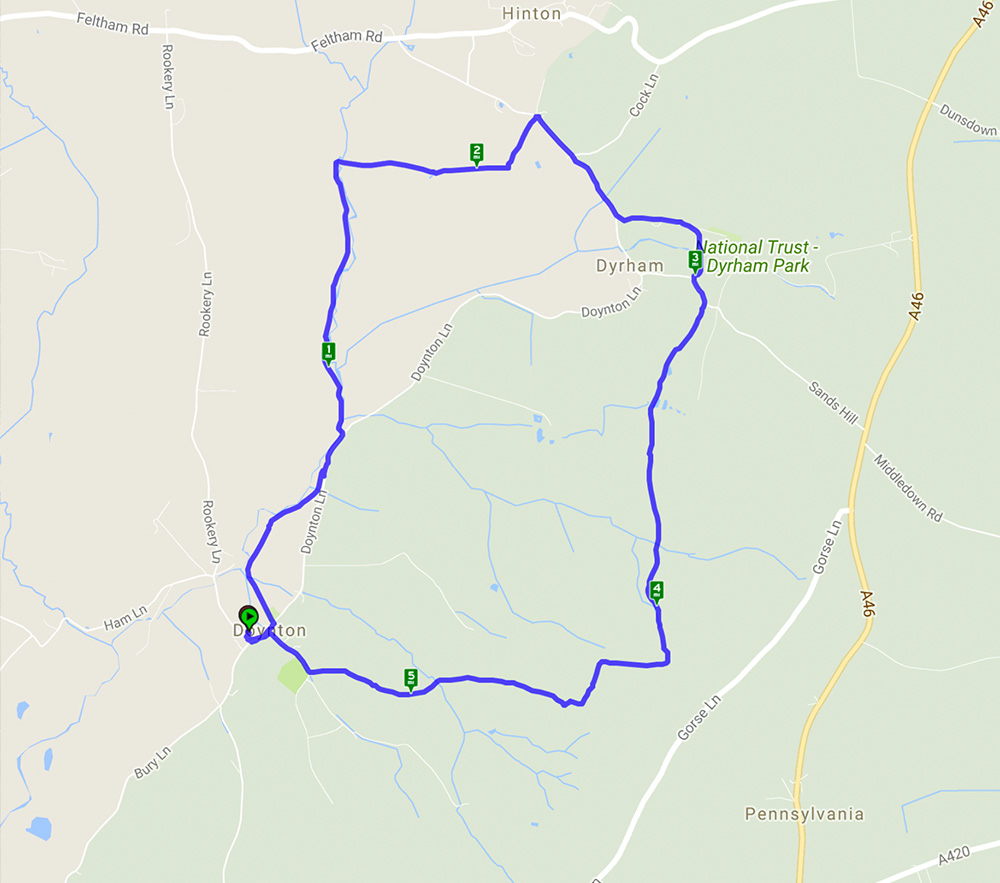
A 5.5 mile walk starting and ending in Doynton
This walk started from the car park of the sadly closed pub in Doynton and went through woods and fields before skirting Dyrham Park and heading back to Doynton. The steep hills were well worth the effort as, combined with glorious weather, the reward was far reaching views stretching as far as the Severn bridge.
August 2, 2017 at 9:08 am
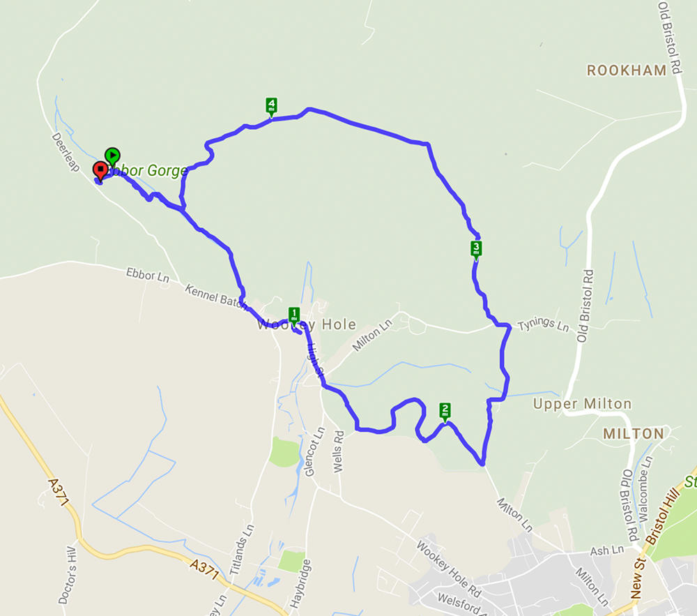
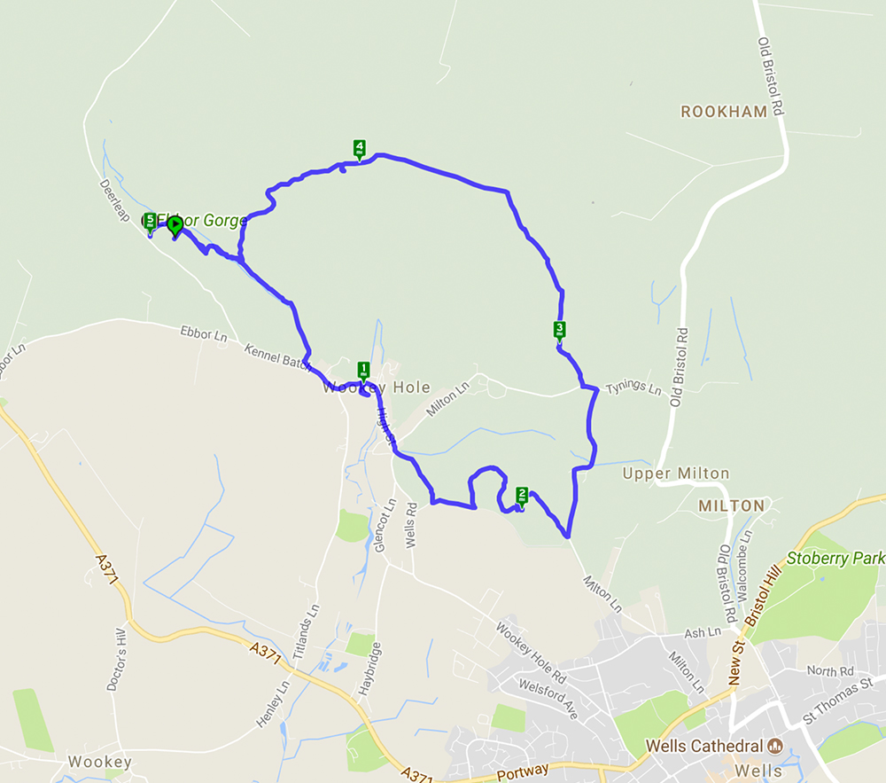
Welcome to our third featured walk which is a 4.9 mile circular hike through Ebbor Gorge on the West Mendip Way. Full instructions are below.
This walk starts from Ebbor Gorge car park and heads down into the reserve before diverting into Wookey Hole village. From there it goes across fields and through woods before returning to the nature reserve and back to the car park. A challenging walk with steep flights of steps and climbs up hills but well worth the effort for the far reaching views across the Somerset countryside. The limekilns and rock formations are an interesting addition.
Recent Comments