January 28, 2018 at 6:24 pm
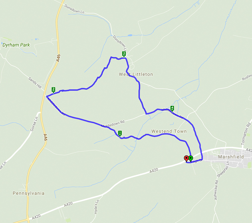
A 4.8 mile walk starting and ending in Marshfield Village
This walk started in the village of Marshfield and after crossing the A420 it followed lanes and footpaths across very muddy fields to reach the village of West Littleton with its very attractive church with a 13th century turret and bellcote. The return to Marshfield passed Castle farm with its turreted farmhouse – very unusual. The views over the rolling Cotswold hills were something of a teaser given the mist and low cloud but on a clear day would have been spectacular.

January 11, 2018 at 10:14 am
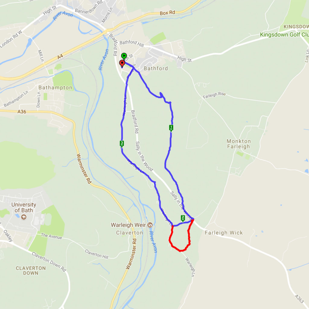
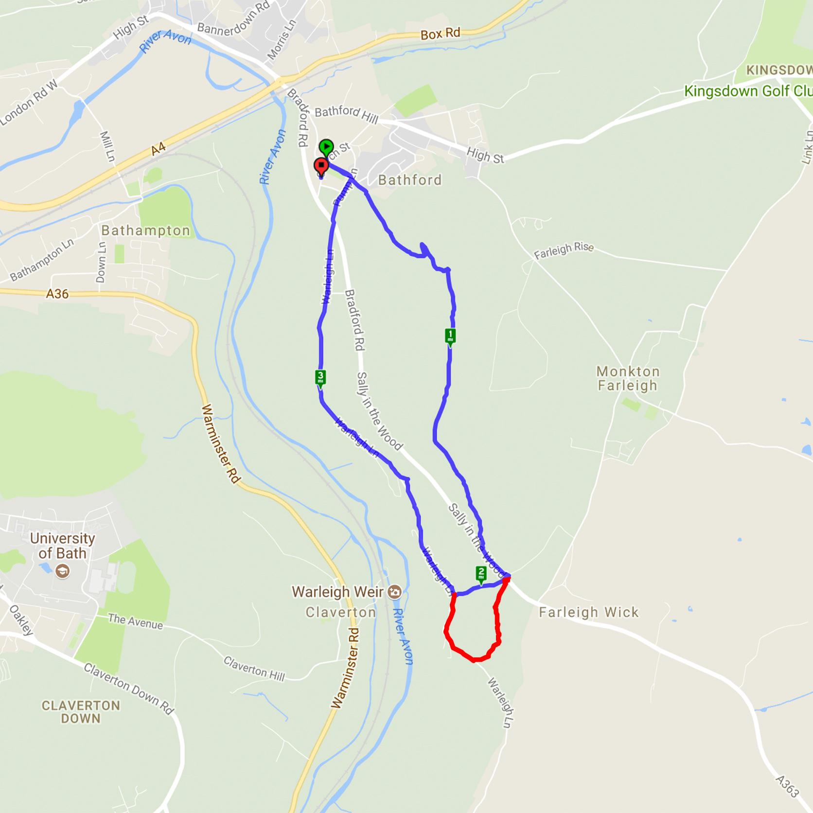
Browne’s Folly Revisited – 7.1.18
A cold but very sunny morning made the ideal conditions for this walk. Starting from Bathford, a steep climb led through woods to Browne’s Folly before descending through the reserve and heading back to Bathford. A slight variation in the route from the previous walk here avoided the very muddy bridleway and was a pleasant, shorter path. The clear skies gave excellent views.
The map below shows today’s route in blue including the shortcut – the extra red bit is the part of the original route that can be circumvented if the path is particularly muddy. You can see details of the last time we did this walk here.
Recent Comments